
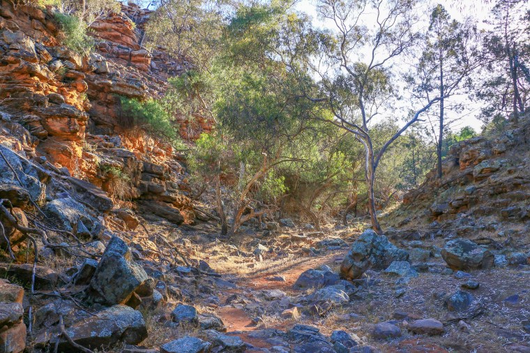
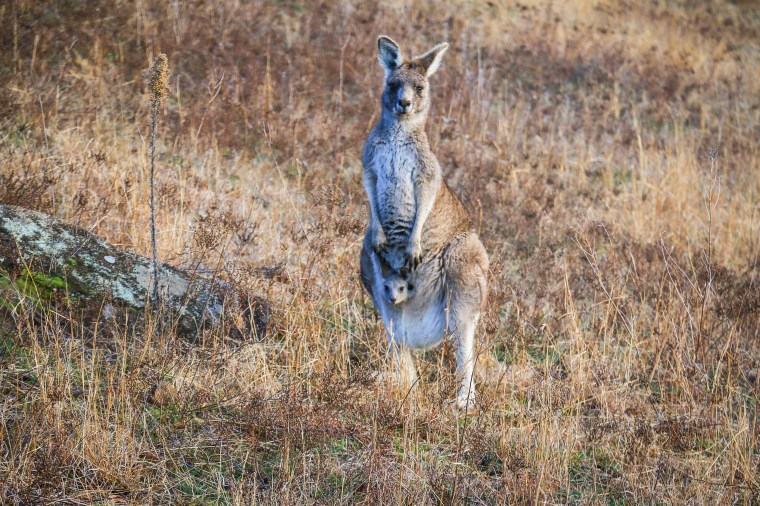
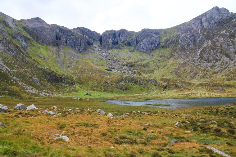
It wasn’t love at first site. As national parks go, it’s not in the top tier. There are no obvious spectacles, no grand high tops, no sublime points, no copper canyons, no vernal falls. But it sits there, looking at you, consumer of sunsets and occasional catcher of winter snows. Endearing itself to you by its very persistence.
Namadgi National Park. Canberra’s park, Canberra’s playground; like Dartmoor is to Plymouth or Hampstead Heath is to North London. Before that, for many years before I came here and other strangers came here, special ground for Australia’s first people. Rising to the west, sheltering Australia’s young capital. A rugged wilderness reminding us of what we were and where we have come. And where we still have to go. Enduring still.
Igniting
The lustre of spring radiated across the valley and lifted the soul the way that spring can only do: that warming sun on your face as you cast your eyes upon a celebration of green, a chirpiness matched by the creatures awakening from their slumber. Treading into this world along the valley floor, each footstep a newfound joy, each pause a chance to breathe it all in. An enclave of life and of love, promising halcyon days ahead.
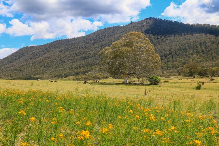
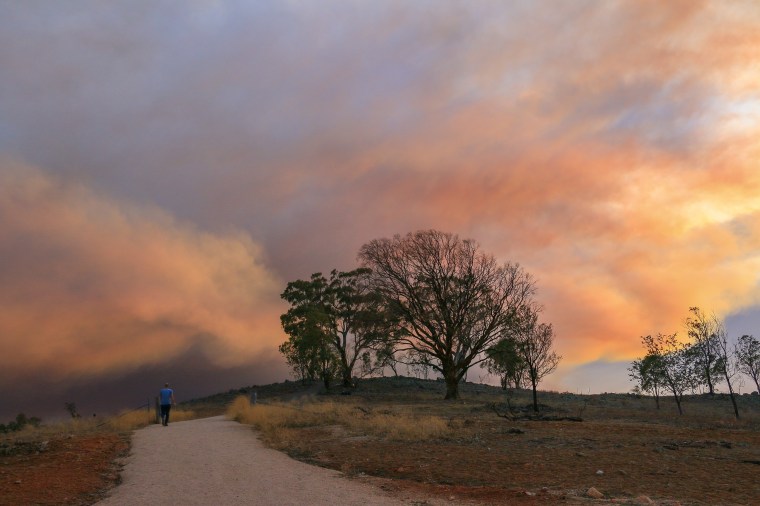
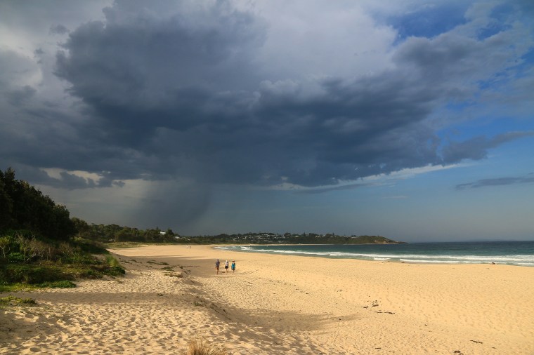
Monday 27th January: A small plume of smoke appears over a hill as I drive back home. It throws my bearings since it isn’t where I expected to see smoke today. I check Fires Near Me for probably the fifth time this morning and see a new blue diamond symbol has appeared in Namadgi National Park. It has been listed as the Orroral Valley Fire.
Taking hold
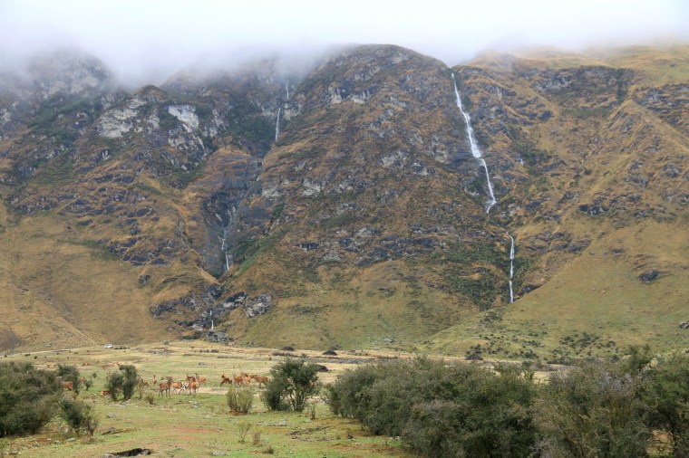
The sky had that washed out tone of winter that threatens but barely delivers. It is the colour of childhood skies beside the sea, when the excitement of snow was dashed by the delivery of icy rain. If you were being generous, you might describe it as sleet, but only that narrow, spitting variety rather than a satisfying splodge. As I climbed through the freshest forest to crest the ridge of Booroomba Rocks, a new squall spilled into the valley of gums below. A wind chill well below zero blew away the cobwebs. And cast a few shards of icy, spitting rain my way.

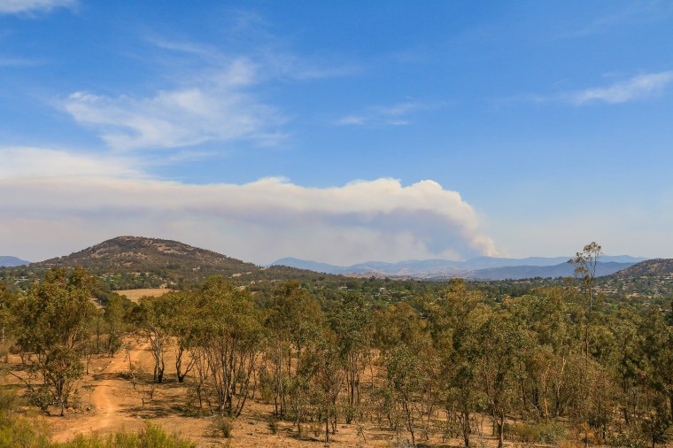
Tuesday 28th January: The fire quickly takes hold and becomes uncontrollable, spreading west into Honeysuckle Creek, Apollo Road and climbing up towards the crest of Booroomba Rocks. A large smoke plume intensifies as the day heats up and spreads many miles west, hanging over the Canberra skyline as multiple planes and helicopters disappear into its heart.

Consuming
We used to have adventures. These often involved hikes to lookouts and – if we were lucky – a bird roll with a view. All across Australia. 2018 offered the comeback tour and an adventure a bit closer to my home.
Older, probably not wiser, I persuaded Jill to join me on the Yerrabi Track, hoping the drag uphill wouldn’t cause consternation. Hopeful that the rocky platform at the end, with a bird roll, with a view, would appease any potential discord at my choice. May I present to you the wilderness. Close to Canberra. And a long way from Norfolk. Or Sydney. A real place to breathe on holiday, or at home.
Thursday 30th January: A few days of cooler and quieter weather provide some respite and a chance for fire crews to lay down containment lines, large air tankers plying back and forth overhead. While much is done to try to protect properties and cultural assets, the fire continues to feed on the tinder dry heart of Namadgi, spreading down towards Yankee Hat and Boboyan Trig, a key marker on the Yerrabi Track.

Threatening
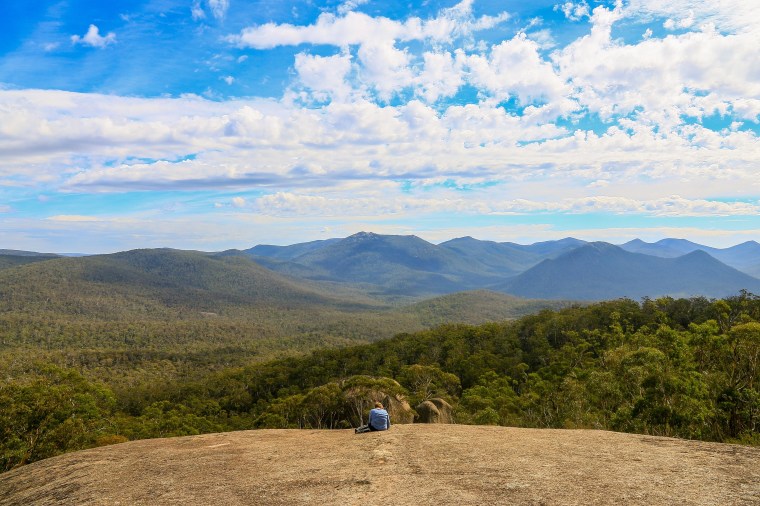
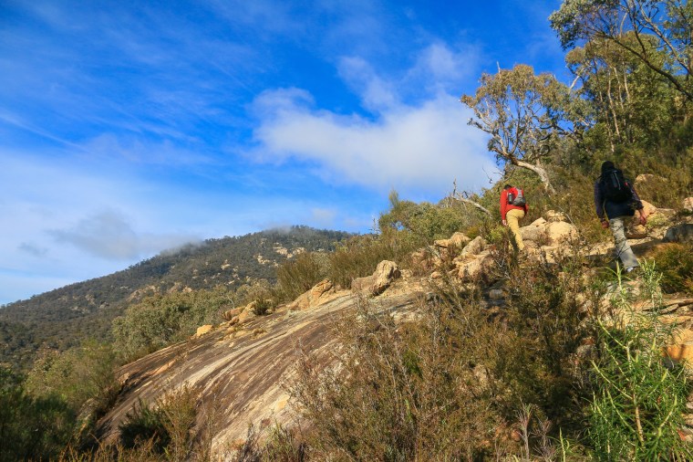
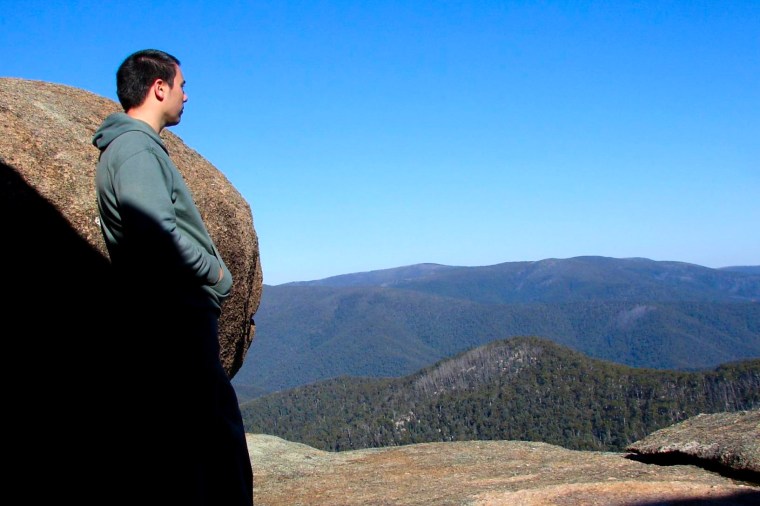
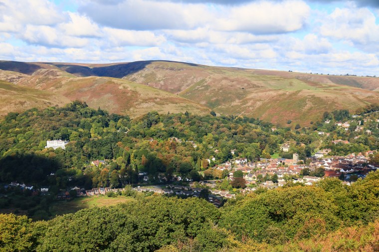
From Canberra, Mount Tennent stands sentinel over Namadgi National Park, 1,375 metres into the sky. The first prominent peak as you enter south, looming over the visitor centre and the small village of Tharwa. In spite of this proximity it took me many years to climb. Cypress Pine lookout was usually as far as I made it before arriving at the conclusion that that is more than enough thank you very much.
Sometimes you need the momentum that comes from walking with friends. An encouraging peloton. A crisp morning that warms with the rising sun on your back. Views that deliver over the Monaro, its golden paddocks strewn with the fairy floss of rising mist. Each step up a shared endeavour, summiting a shared prize. Victors in a deep blue sky, miniscule among uninterrupted green.
Friday 31st January: The temperature nudges towards 42 degrees and the fire threat escalates, creating spot fires which push into NSW. Authorities publish worst case projections for the fire spread that – should they come to bear – would spill further down from the summit of Mount Tennent and consume Tharwa, before entering the far southern suburbs of Canberra. The ACT declares a state of emergency and the city is on edge.

Tearing south
I can recall the pleasure in discovering something new; a circular trail in the deepest dirt roadiest section of the southern ACT that scored high on the effort-reward ratio. It was nearing Christmas and I had been in the city that morning, catching up for coffee and passing on gifts. By afternoon I was gently climbing up through forest onto the ridge of Shanahans Mountain. The reward: a fluffy clouded blue sky hanging over the wild contours and emptiness of the Clear Range. Christmas had come early, a new vista my present.

Saturday 1st February: A brutal day of solid northwest winds and temperatures reaching 43 degrees expanded the fire quickly southeast across NSW and upon settlements around the Monaro Highway, including Bumbalong, Colinton and Bredbo. While Tharwa and suburban Canberra dodged a bullet, around a dozen homes were destroyed, principally around Bumbalong as fire raced over the Clear Range and engulfed properties.
Creeping north
I wonder if there is anything more satisfying than the scrunch of footsteps upon fresh snow. While chaotically parked cars and excitable humans rapidly transform Corin Forest into dirty slush, ahead of me is a virginal path of white. It took some effort to reach. Lung-busting in fact. But before me, the Smokers Trail slices through a forest of tall, majestic eucalypts under the deepest blue sky. It is a wonderland both un-Australian and undeniably Australian. Waiting to be scrunched underfoot.

Thursday 6th February: A week of cooler, calmer weather subdues fire activity considerably, though it continues to slowly expand, particularly to the west and north. It has passed over the Smokers Trail, nearby Square Rock, and moves over and beyond Corin Forest. The slow creep of the fire appears less destructive and the infrastructure around Corin Forest is protected. Now nearing Tidbinbilla, fire crews instigate backburning to halt progress.

Enduring still
Is it as simple, as logical, as linear as a before and after? Because a before was also an after. When I took my first steps into Namadgi it was not so long after 2003. When the hills and gullies had previously burned, arguably even more vehemently than today.
In the much used vernacular of the new normal it may not be quite the normal cycle of the Australian bush, but there is a cycle nonetheless. We may be in the immediate after now, but I can take solace that this is the start of another before. When Namadgi will again nurture love and life, expel fresh air and bounty, guide adventure and inspiration. Enduring still.
Sunday 9th February: The rain is tantalising, teasing. We’ve had a few millimetres and promises of a deluge keep getting pushed back. Another hour. Another day. Probabilities suggest something decent will come. A few spells of drizzle and blustery showers mimic England. It is only seventeen degrees and perfect roast dinner and red wine weather. That in itself is an encouraging sign.
The Orroral Valley Fire has changed status from Out of Control to Being Controlled. That in itself is an even more encouraging sign. It has consumed around 80% of Namadgi National Park and around a third of the ACT’s landmass. Taking into account various offshoots into NSW the fire encompasses approximately 113,000 hectares, or 1,130 square kilometres. That’s about the same as Hong Kong Island. Or most of Greater London if you exclude some of the crumby bits like Croydon.
Initial reports suggest significant variability in the damage caused within the park, mirroring the variability in fire intensity over its course. Positively, key infrastructure, including historic huts, culturally significant sites and telecommunications resources have been protected, while threatened wildlife within nature reserves have been successfully relocated.
It is one small footnote this summer.

 There is a colony of koalas here, and I was pleased to come across one in the first hundred metres of my walk. It was around midday and hot, exactly the kind of conditions in which you should not be out walking. But with this early sighting, the pressure was off – no more relentlessly craning one’s neck upward in the usually forlorn hope of spotting a bulbous lump that isn’t a growth protruding from a eucalypt. I could instead loop back to the car concentrating more on keeping the flies from going up my nose. Yes, they are absolutely back.
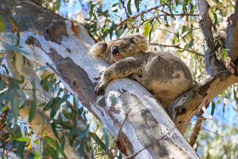


 Still, should you wish to rise from this indulgent slumber, another hour or so east will bring you to the western fringe of the Blue Mountains. Suddenly things change, and not just the petrol price rising thirty cents a litre in as many kilometres. The day trippers are out in force, the coaches idling at every single possible lookout, of which there are many. The escarpment top towns of Blackheath and Katoomba and Leura are brimming with people shuffling between café and bakery, spilling down like ants to the overlooks nearby. Below the ridge, however, and the wilderness wins. Only penetrable at its fringe, placid beneath a canopy of ferns and eucalyptus.

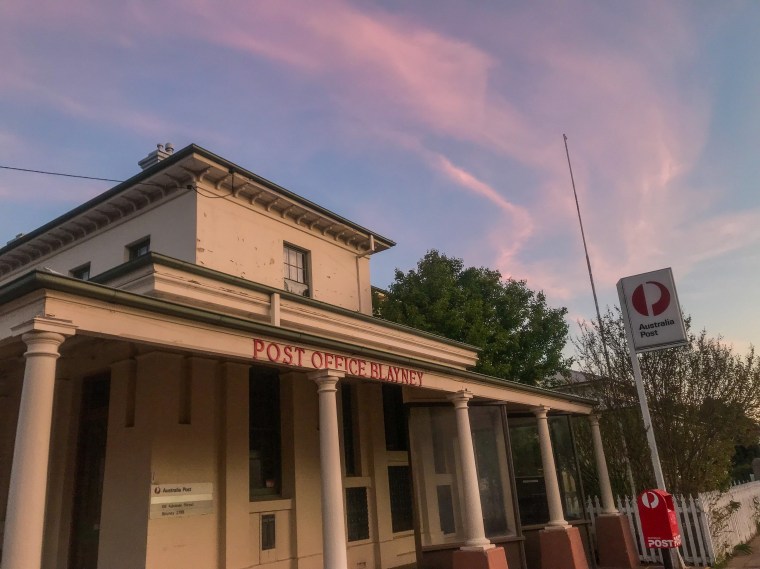
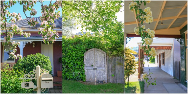
 With the undeniable passage of nature there are sure signs that winter in Canberra is slowly ebbing away. There have been a few recent days in which I have left the house without a coat, while the sunlight is waking me up well before seven and allowing me to read almost until six. Wattles explode, daffodils unfurl, the odd fly is resurrected and finds its way into my living room for what seems like all eternity.
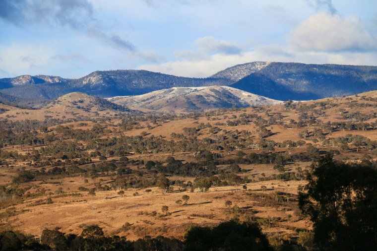


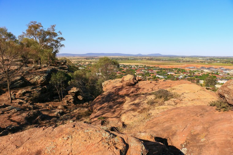
 I guess a triathlon is a bit of a googly within the normal course of events. It also led me to be in Hackett one sunny late afternoon, at the northern end of Canberra nestled underneath Mount Majura. Not so much a change of scenery, but at least a different path on which to wander, all stretching eucalypt branches, golden grass and copper earth, with some snatched views of the surrounding landscape through the bush. Plus, slithering away as I marched downhill, a brown snake disappearing from the corner of my eye.


 It’s a tough gig, and the reality of four straight days in a row above 40 degrees was enough to force me fleeing to the coast, at least for a couple of those days. Thankfully when I got back there came a reprieve with temperatures dropping back down to 37 with a cool change as ineffectual as any number of Secretaries of State for Exiting the European Union. Yes, the hot air persists.
 At least on the coast the temperatures dropped a good eight to ten degrees, pampered with pleasant sea breezes and clear cool waters. There was fish and chips and ice cream, paddles upon shores and across inlets, and a decent amount of lounging with a book in the sand. Yet the highlight of this escape was away from the edge of the water. Instead, upon the edge of wilderness.


 It was borderline whether I had really earned what was to follow, such was the relative ease of this walk. Out of the wilds, the cutesy hilltop town of Milton inevitably has a bakery, which I inevitably visited, inevitably not for the first time. There is a pleasing inevitability in the inevitability of cake and coffee.

 Facing a long drive back from


 Still, sheltered by untainted forest and rolling coastal hills, kissed by the radiance of the crystal ocean under clear skies, there is certain comfort to winter here. It is at one tranquil and vivacious, glowing in a freshness swept in by cold fronts and a seasonal lull in nature’s freneticism. The tried and trusted walk between Depot and Pebbly Beach proves to be at its very best.
 The kangaroos and wallabies appear to be fans of this weather, out in force grazing on the luscious fringe of grassy dune and really, really hoping for a stray sandwich. While far from the explosion in #quokkaselfies on Rottnest Island in Western Australia, the placidity of these animals – along with the idyllic Australian coastal setting – have made #rooselfies a thing, sort of. Especially when there are tourists about.
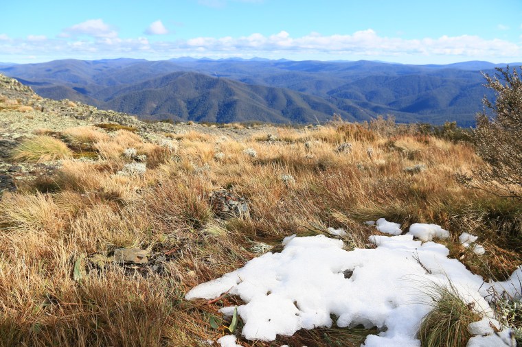


 Fast-forward a few days and the work was done, proving less cumbersome and far more populated with coffee and cake than I could have hoped for. This left me alone with a car and a few belongings close to the Queensland-NSW border. A massive part of me wanted to make the journey home as quickly as possible, but then an equally massive part also yearned to stop in Warrumbungle National Park. Another significant consideration was a determination to miss the whole messy Newcastle-Central Coast-Sydney conglomeration. This along with the fact that, heading inland, I could go through Texas tipped the scales definitively south and west. Yeehaw.


 I was even more glad of my foresight in buying some hot cross buns and a block of butter in Coonabarabran yesterday. What better way to use the camp stove for the last time, to set me on my way to Gilgandra, to Dubbo, to Wellington, to Molong, to Canowindra, to Cowra, to Boorowa, to Yass and – 550kms later – to Canberra.


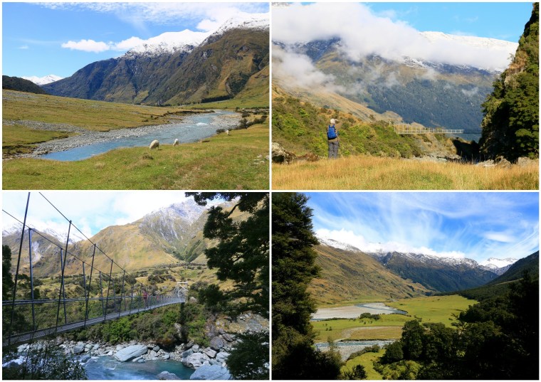
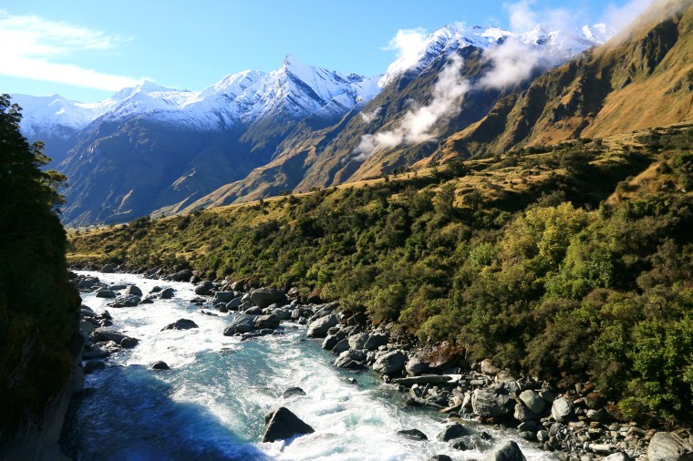

 In some ways the end of the track is something of an anti-climax, but only because the entire journey getting there has been as, if not more, enjoyable. Terminating close to the glacier, yet another waterfall for company, it is an ideal sandwich stop, a platform from which to take photos that cannot capture the all-round panorama of ice and snow and forest and water under big blue sunny skies. Dad and I two insignificant specks of unintentionally coordinated orange that have passed through the storm and into the light.
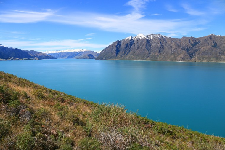
 Lake Wanaka eventually ends and narrows into the valley of the Makarora River. Just past the township of Makarora another popular stop for caravans and coaches and cars and cameras are the jade pools of Blue Pools. With a gentle walk through a forest overflowing with hobbit hiding holes, two swing bridges and stony beaches suitable for building thousands of stupid piles of rocks that might look good in a picture but disturb the natural ecosystem, this is a busy spot. But yet again, as so many times in New Zealand, you can forgive the constant flow of people given the sheer beauty of the place, cognisant that you are just another nobody adding to the crowd anyhow. And with people comes stone-skimming fandom and plenty of fresh blood for the delightful sand flies that are in even greater abundance.

 Happily, the sunshine continued into the next day and it was good to finally see our Lake Hawea surroundings in a golden light. What comforted with cosiness during the storm also shone with charm in the summer sun. To me, Lake Hawea proved a good alternative to Wanaka, barely down the road but without the crowds and providing much more space. Indeed, under such big blue skies it was a shame to leave, to miss out on sitting in the garden, foraging in the greenhouse, rubbing the cat’s belly on the grass. But there was time for one last amble down to the lake shore, to the blue and green and gold and white of just another amazing little corner of this country. And time then to move on to yet another one.
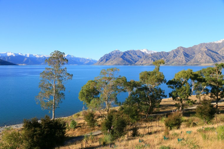


 It was a noisy night in a house on the outskirts of Twizel. Not because of hoons doing burn outs or rampaging feral possums, but the iconic sound of raindrops on a tin roof. Many Australians go misty-eyed when you mention the sound of raindrops on a tin roof, as if in some kind of messed-up ballad by Banjo Patterson accompanied by dreadful Lamingtons, but I don’t see the appeal. How the fricking heck do you sleep? Turns out this rain may or may not have been associated with cyclone Gita, or ex-cyclone Gita, or whatever was heading our way for 48 hours or more…

 Generally, I prefer waterfalls to crowds of tourists, but the crowds of tourists can provide useful guidance on the location of scenic stops. Like a tree on Lake Wanaka – That Wanaka Tree – which probably has its own Twitter account and features on every second Instagram post with the hashtag newzealand. We join a semicircle of tourists taking pictures of the tree, with the tree, around the tree, through other trees to the tree and generally marvel at the tree, which is a very pleasant, photogenic tree. And frankly, you can’t ask much more from a tree. Other than it to grow money…which it may have done given its ubiquity on the internet.
 More waterfalls were spotted on a drive to the northern side of Lake Hawea late in the day. A stop for some Dad fishing which yielded a stop in the rain. Briefly the sun even emerged albeit a touch watery like everything else around. But for the first time in a long time the windscreen wipers on the car could be set to zero. And as we parked up following a peaceful drive back home, without a fire or cat in sight, the sky miraculously fired up red, to the shepherd’s – and tourist’s – delight. Perhaps the storm had come, and gone.
 The stream of people continued along the first, generously wide and paved section of a trail, thinning slightly with the introduction of a junction. Before long, an incessant parade of steps appeared, the upward thrust causing pockets of walkers to pause and congregate in clusters for water, snack bars, some even breaking out a stove and cooking up a soupy concoction. Barring a handful of souls, almost everyone was Korean and I received the odd, surprised, what is he doing here look. One old guy offered me a boiled sweet in broken English, proclaiming them as the elixir to conquer Jaunbong. In our stilted conversation, he deduced that I was from Austria, noting his love of Mozart and possibly proclaiming the hills to be alive. For an Austrian, such climbing as it was here should be a breeze. For an Australian: faaaaaaahk.
 There was no breeze and it was tough going…particularly given it was the day after I had arrived on a plane from England and then gorged on fried chicken. Some welcome respite came at Cheonchuksa, a small detour leading away from the upward procession and revealing a temple and its various ornaments snuggled into a cliff. Simultaneously serene and vivid, offering fresh water to refill bottles, to take a break, to tread briefly on level ground and tiptoe in a suitably reverential hush. I could have lingered and napped.
 But apparently the path to enlightenment continues up and up, past increasingly frequent groups pausing for food and water, wiping sweating brows, recovering breath and looking somewhat abject. Eyes silently pleaded when would this end, how much more of this would there be? Signs that were once in Korean and English had reverted to Korean but I deduced there was something like a kilometre to the top. And it probably took an hour, but after that time a rocky crag appeared above the forest. Bedecked with yet more picnickers, convivial and relieved, catching hazy, smoggy views of the hills and occasional snatches of suburban apartment tower sprawl.
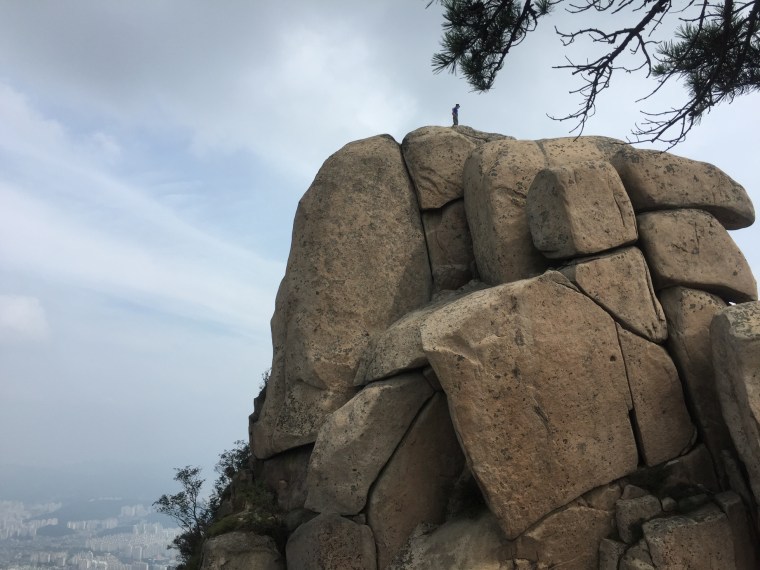
 The path to enlightenment is never easy and after a long slog upwards all day it was only when gravity was on my side that I fell completely ass over tit. A winding, gravelly descent was more competent than my footwear and I received a very nice caking of dust over one side of my body. No-one else was present to witness this event, something I was actually pleased about in terms of embarrassment management. It’s kind of like if a tree falls in a forest and if no-one is around to hear it, does it make a sound?
