Growing up, Christmas TV viewing used to be such a big thing. A double episode of Eastenders in which someone and/or something sizzles in a suspicious blaze. A blockbuster movie that was so new it had only aired in the cinema little more than a year previous. A Father Ted comedy special which was really fecked. And of course – usually avoided because of concurrent feasting on dried up old turkey – The Queen.
While others still go crazy over Love Actually or A Muppets Christmas Carol or even the old royal turkey himself, I have mostly been watching the BOM radar this holiday season. Only Big Bash cricket – for all its stupidity – competes for airtime, though usually in the background, usually while looking at the BOM radar. It’s riveting viewing, where you simply won’t believe the biggest twist yet.
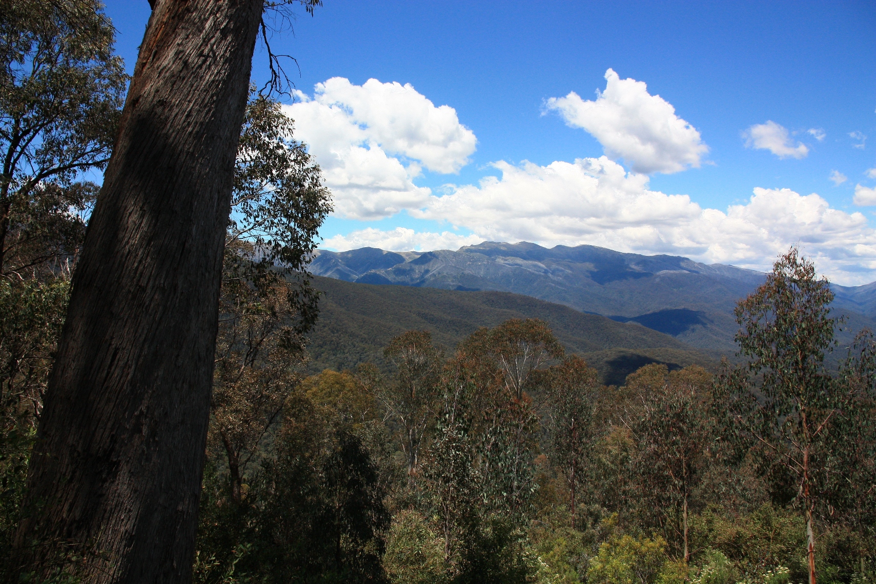
They say Christmas comes around earlier every year and it was just ticking over into December when BOM radar became the must watch event of the year. Was Mount Kosciuszko up in the clouds, was that storm clipping Thredbo, would it ever stop raining in Jindabyne? Would Yarrongobilly Caves provide best refuge or how about the local pub? As long as you get in after the meat raffle and before the Christmas karaoke, yes.
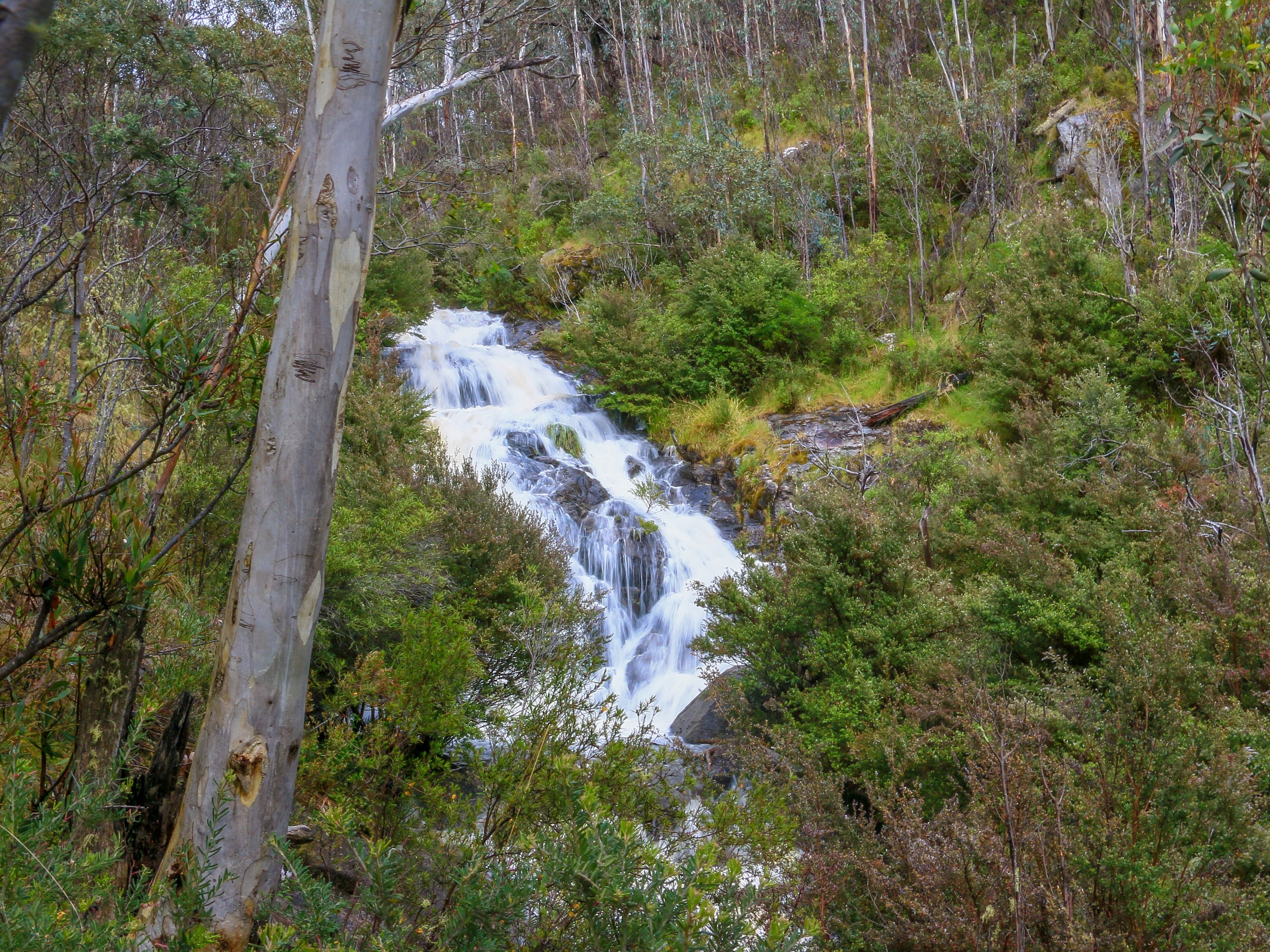
Rain, rain go away and come back in the form of a waterfall. A lull in weather drama one morning providing relief and release and joyous, primitive, natural freshness. Sawpit Creek plunging and fizzing and totally out of mobile range to check the radar. Ignorance and bliss and all that.
Nimmitabel also produced sketchy mobile data and all I can say about that is it was a stroke of luck that I fancied a pie. Or, supposedly, Cornish Pasty. While discovering the sacrilege of sweetcorn the heavens opened, rapid rivulets formed and I prayed for the car outside. By time I forced down the last corner of dry pastry it had stopped, and Dad and I plunged down towards the coast.
I wouldn’t quite say the rain followed us. At least not until after we navigated flooded detours in the Bega Valley, stopped the car, and went to discover sea foam oozing through Wallagoot Gap. Only then did the rain return, obliterating the scenic drive to Bermagui and forcing fish and chip consumption in the car.
There was clearly a bit of a British summer holiday vibe going on. This extended to the following day when it was – in spite of more downpours forecast – only really mostly cool and cloudy. Relativism a conduit of positivity, low expectations a nurturer of delight. Mustn’t grumble. Things could be worse. We could do something.
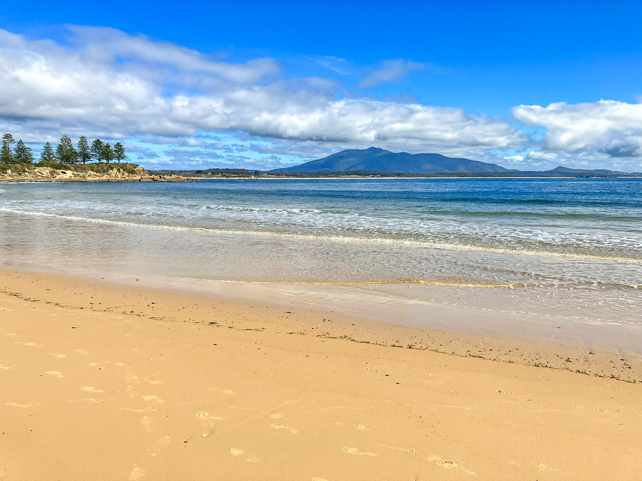
It wasn’t really a peachy beachy day, unless seeking moody shots of rock formations and blustery coastlines. So we ended up in Tilba, drinking coffee and eating cheese. In between, taking a tour of its lush environs under the brooding hulk of Gulaga. Briefly the sun came out, and so too the flies.
With all the runoff of recent days the normally sapphire seas around Bermagui were a bit more Bognor. But Monday – the day of travelling back to Canberra – was much better. Radar viewing indicated little going on, much like a filler episode of Home and Away (or a normal episode to be fair). There was good coffee on the beach to kick things off, good waterside coffee again in Narooma and fish and chips by the lake in Tuross for lunch. Filling the time between dining stops, beach views and maybe the risk of sunburn.
In fact we stopped stopping at beaches because we were tiring a little of golden sand and fabulous blue waves. A bushwalk among the spotted gums was calling. A search for elusive butterflies and a surprise sugar glider, taking advantage of a respite in the weather to feed on nectar and ambrosia. Inspiration for the ice cream at Bodalla Dairy.
For a day, BOM Radar was barely a thing. The Australian summer in all its glory was back. Even the sea started to look that little more sapphire. But then I heard they commissioned a second season. Featuring a Christmas special. In which there will be some even bigger twists you never ever saw coming in an unprecedented TV first. Oh how I hark back to a spot of arson among the mince pies in Eastenders.
Freedom. We hear much about its supposed decline. Personally, I’d quite appreciate the freedom not to be exposed to a bunch of conspiracy nutjobs freely protesting about their lack of freedom and flaunting their undeniable individuality through exemplary selfishness. The freedom not to have my head done in.
Sometimes you just want to say “oh f*ck off” and sometimes I do just that when a news story about freedumb fighters forcing cancellation of a charity book fair or abusing a masked-up pensioner or accosting a sixteen year old in a supermarket trying to support the safety of the community gets an airing on the radio. Seriously fuck right off you fucking freeloading fuckwits. Excuse the language but free speech and all that yeah.
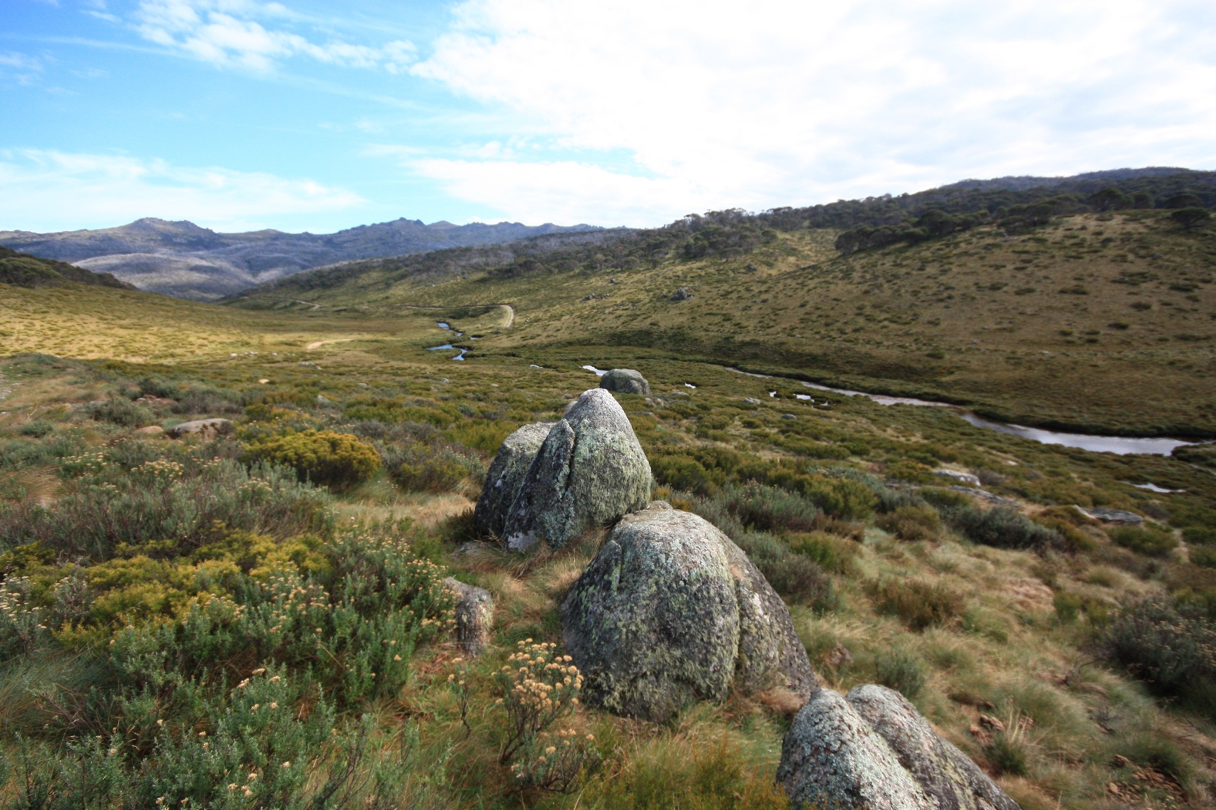
At other times it would be nice just to get away from it all, lose radio reception, lose phone signal, lose the presence of moronic people. A solace fairly easily achieved on a comfortable drive down to Kosciuszko National Park and then via your own two feet. Nature, fresh air, rugged wilderness, freedom from freedom.
On the pursuit of freedom I’ve been finding appeal in the idea of multi-day walks of late (or bike rides). Admittedly most of that appeal gravitates towards the South West Coast Path or the Hadrian’s Wall Path or the Cleveland Way or any other number of routes traversed by Portillo, Humble, Green, Reeve, Robinson et al. and delivered to me via the SBS evening schedule. The kind of walk where you can stop after a mile for tea and cake, pushing on for a lunchtime pasty before reaching a quaint coastal village for a pint, feed and cosy room for the night.
Thanks largely to its wildness and locking up of much of the land, such walking experiences are harder to find in Australia. Instead, multi-day hikes are more intrepid affairs requiring the portage of camping gear and emergency beacons and snake bite kits. I would probably quite like these too, if I had a Sherpa. Many people head into Kosciuszko to do as much, and the cars parked at the trail head in Guthega on a Friday indicate some are out there now.
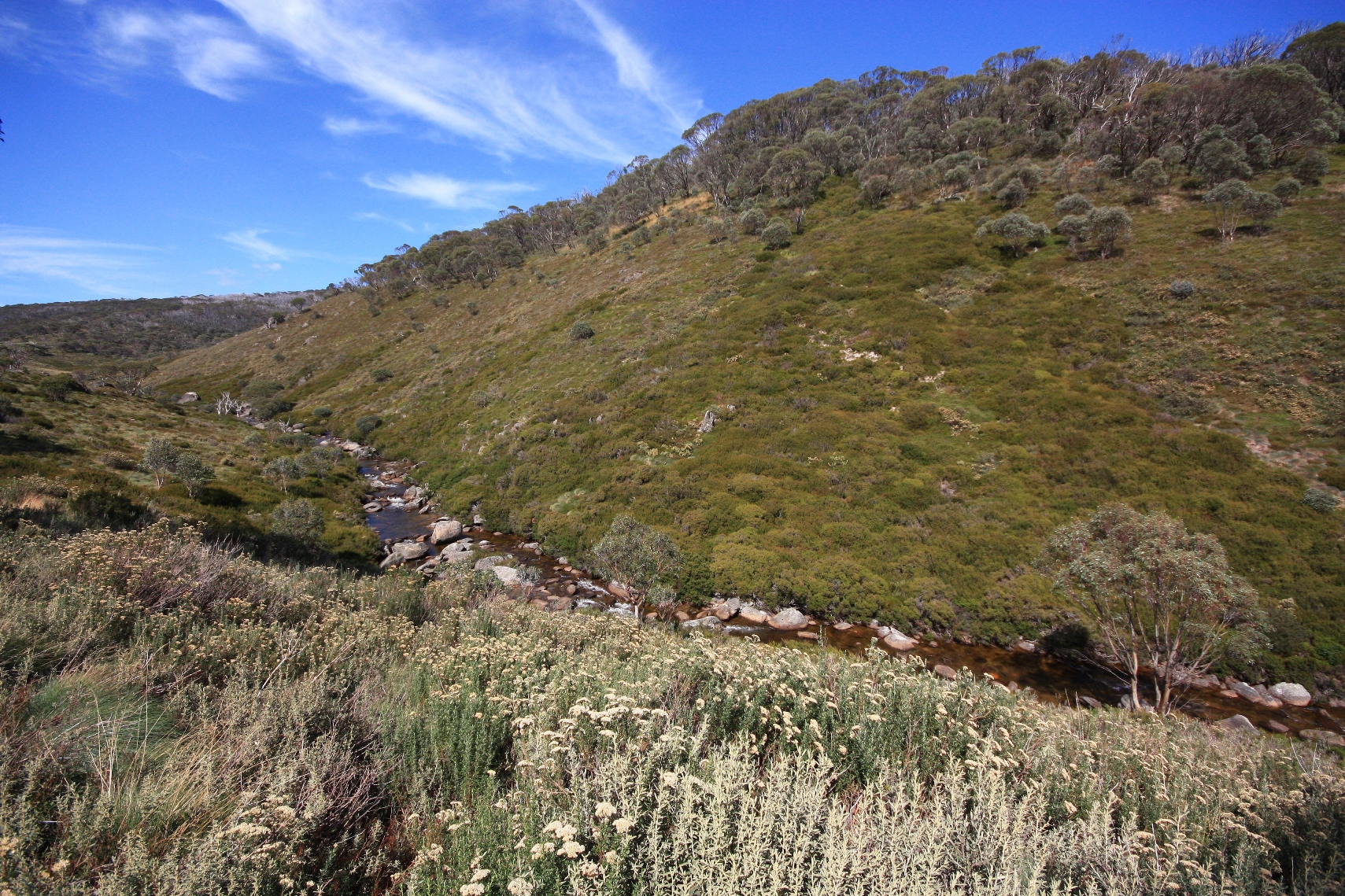
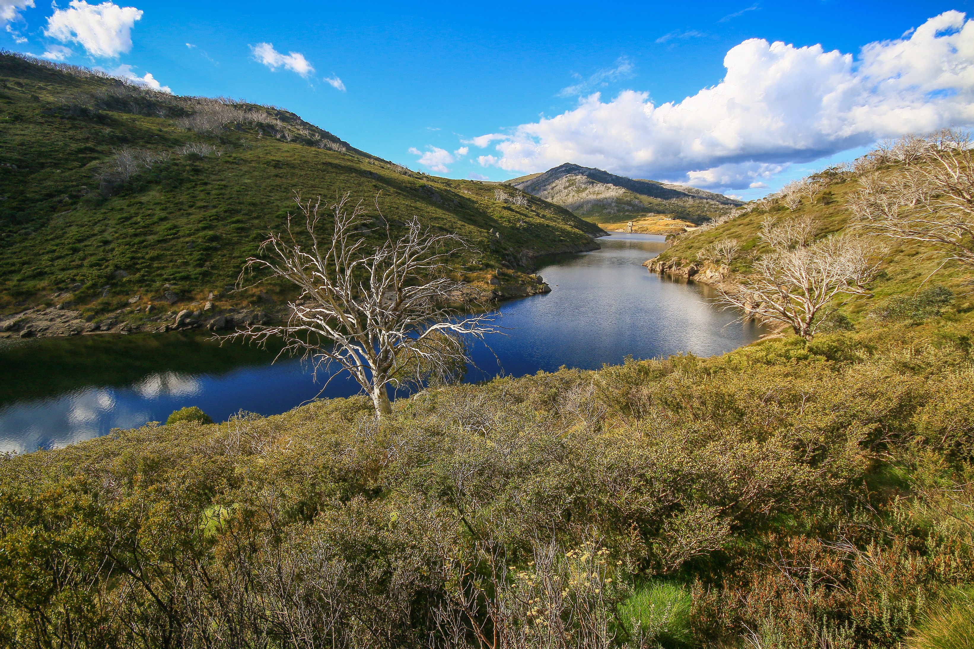
I too park my car up to join the Illawong Walk, slightly anxious about leaving my new second-hand toy overnight. My backpack too is full, but compact in size. Mostly it contains a change of clothes and extra layers and, of course, a flask of tea and accompanying treat from a Jindabyne bakery. Passing the upper stretches of Guthega Dam, through herbaceous meadows and spiky wildflowers, it doesn’t take long to reach the suspension bridge across the Snowy River. An opportune spot for tea and cake already.
I had first come here almost a year to the day. Back then it was warmer and glowing, a delightful surprise full of sunshine, vanilla-honey aromas and Sound of Music earworms*. At the bridge I noticed a new track under construction. Destined for Charlotte Pass. And one year later it is clear. It is free. It leads – sort of – to a hotel.
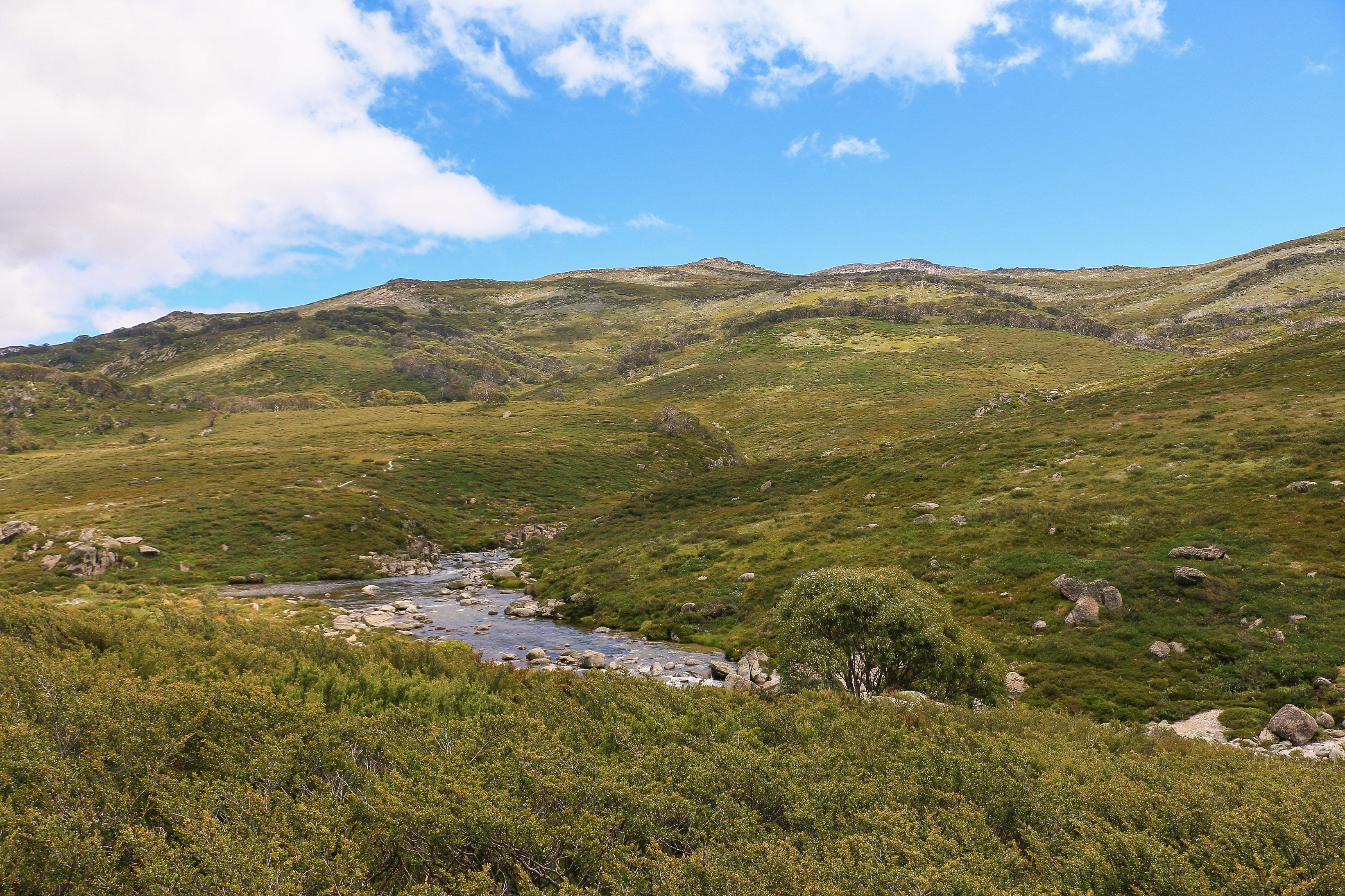
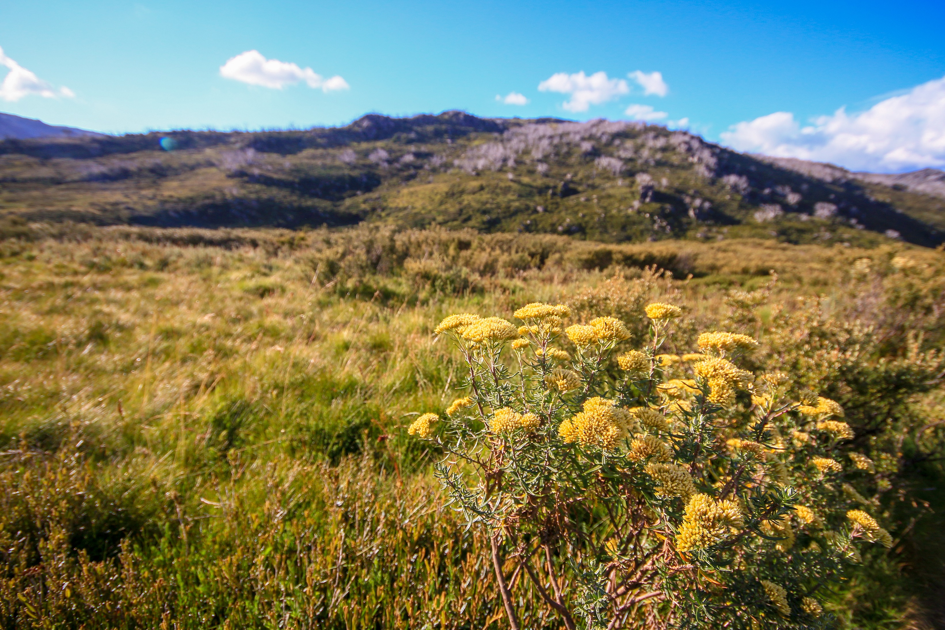
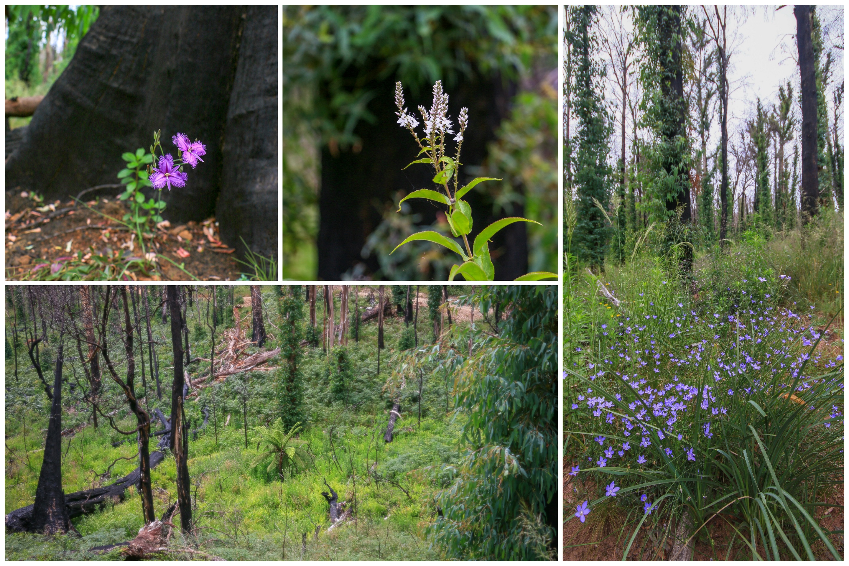
And so the walk continues to follow the Snowy as it meanders through open valleys and rising hills ever nearer to its source. While at times the vistas are expansive, at others the experience feels enclosed, contained, inching through tunnels of achingly beautiful and impossibly smooth snow gum. Alpine flowers form in clusters of white and yellow and pink. From near and far, the crystal waters of the river alternate between wide, placid pools and frenetic ribbons of white.
The walking is good and never especially steep, with much of the route marked by a metal walkway elevated from the ground to protect the rare and fragile environment underneath. Its newness is clear and sometimes you feel as if you are the first to tread its course. There are other people testing it out, but even these are few and far between.
Closer to Charlotte Pass people become a more common occurrence as the trail intersects with the Main Range circuit. More familiar views open up, from the stepping stones across the river to the outline of the trail weaving upwards towards Blue Lake and Mount Carruthers. One of these rounded humps is Mount Kosciuszko itself, so indistinct and underwhelming as the nation’s highest summit. But this is still a lumpy topography, something I am reminded of once again in that arduous push up to the parking area at Charlotte Pass.
Charlotte Pass village is nothing more than a cluster of ski lodges and cabins which are no doubt a lot more abuzz in winter. It’s another kilometre or two down the road, a fairly uninspiring drag that will be worse in the morning when walking in reverse. At the road junction down to the village a truck displays a massive red billboard promoting food, drinks and coffee. The one and only thing open.
This is the Stillwell Hotel and it also has beds for the night. It becomes clear pretty quickly that I am the only guest. I find it strange and sad that these places are so dead in summer, given the access to many walking routes and biking opportunities and extreme running and perhaps some fishing and possibly just a lovely picnic amongst the wildflowers. Still, at least there is something open (this is an improvement on past years) and there is food and drink being served. For me, a pizza overburdened with cheese will hit the mark, and provide catering for lunch tomorrow.
I theorised I could make this a proper multi-day walk by heading to Thredbo the next day, stopping over at another inn for the night. But there wasn’t much room, Thredbo now the mountain biking mecca and hosting some x-games rad-fest over the weekend. Instead, my hiking adventure merely involved a walk back to the car along the same route. Still, there are new perspectives to be had from a different angle.
Not that I could see the next morning, negotiating the incessant upward angle to the end of the road high in the clouds. Mist and drizzle swept into the valley, adding to the bleakness of Charlotte Pass village and its Stephen King feels. I decked myself out in every layer I owned, hood pulled up and wedged tight by a hat. A few cars passed as I lumbered my way toward the parking area, and I wondered if they thought I was some intrepid adventurer and / or serial killer.
Many, many cars are parked here and it is interesting to see how many days they have booked to be in the national park. Expiry dates on windscreens provide entertainment in the mist and you wonder how those people with three days left are going out in the wild. Other people are just here for the day, and a few gaggles embark optimistically for the lofty summits somewhere out there.
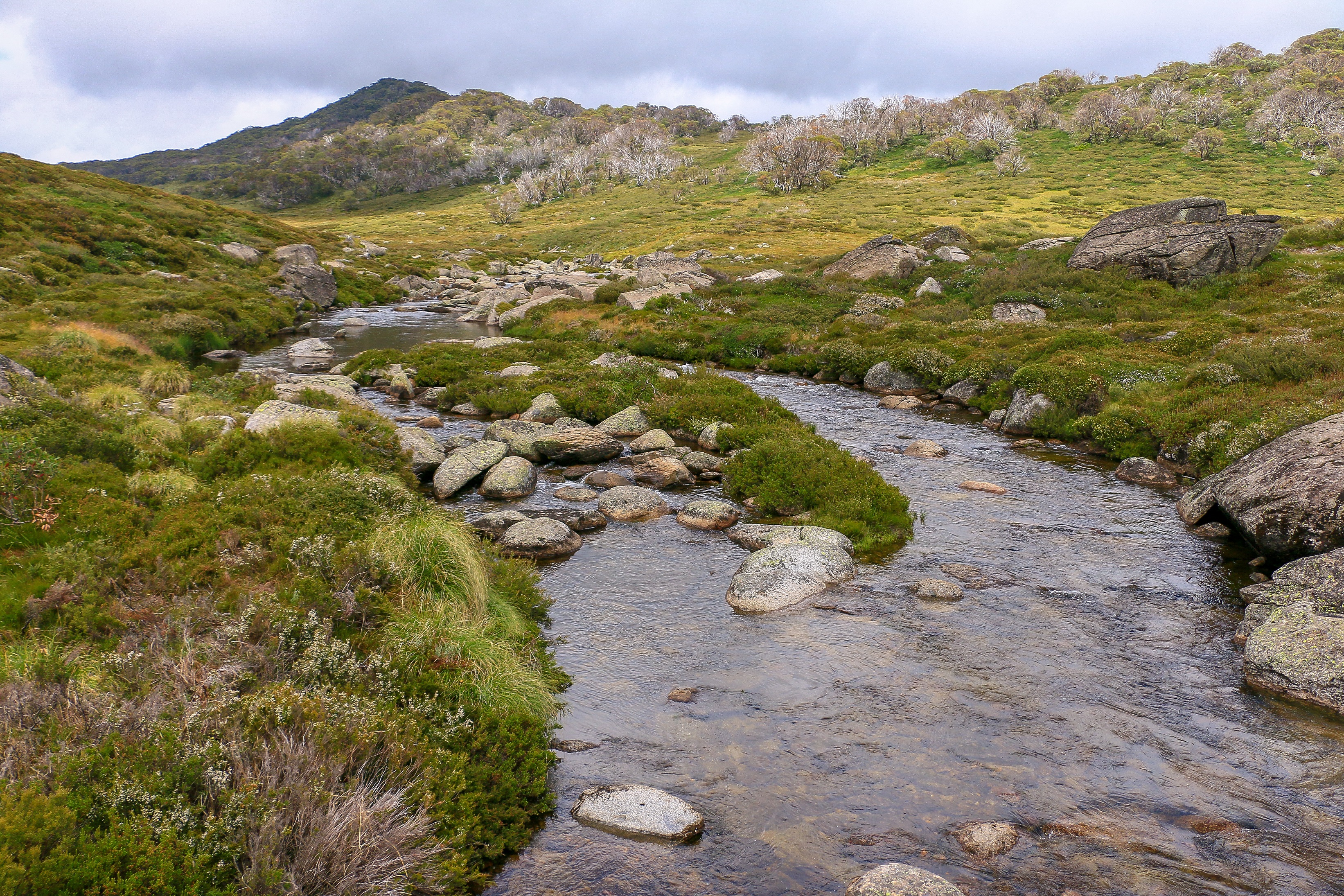
They should be fine. As I re-join the trail back to Guthega the clouds are starting to break up and passing glimpses of hillside and snow-dotted summit provide hope. The dour, swirling air seems to accentuate the beauty of the snow gums and the fragrant shrubs and the pin pricks of delicate flowers scattered among them. Small spider webs are bejewelled by the rain. The river sounds closer and reassuring, a clarion call to guide through the grey.
With a gradual descent the clouds rise and there are pockets of blue sky ahead. A series of summits are illuminated bright, bare hills erupting in shattered outcrops of rock. There is a sense of Dartmoor at times, and in other places a sense of Wales. But no refreshments in a cosy teashop a mile away.
Instead I have my flask and a big bar of KitKat, though it took some time to locate a suitable rock to sit on for morning tea. Further on, past the suspension bridge and close to the car, I finish up the pizza. By now, there are many more people setting out on a Saturday, lugging hefty backpacks with rolls of canvas and sleeping bags and kitchen utensils. Seeking their own freedom.
I am unsure why the final half a kilometre of a long walk always involves a ridiculous uphill drag. I probably could have parked closer. But I am pleased to see my car there, and pleased to see that it opens and starts. Now I am free to drive and free to stop in Jindabyne again and free to fill up with the very opposite of free petrol. Freely cruising up the Monaro and back to my home in Canberra, free of vaccine mandates and usually free of morons. Until they arrive from elsewhere. Both sitting in the nation’s parliament and camping at Exhibition Park. Strangely doing, pretty much, whatever they like.
* current earworm: Hasselhoff. Freedom. Oh, you too?
It is beyond doubt that coronavirus has altered our perception of the exotic. Whether it be Gundagai or the garden centre, there is much greater thrill to be had in what was once so mundane. I kind of like this revived appreciation for what is immediately around us, as we persevere in seeking out that which can still be discovered. A new view, a different seat, a random town. Or even just a change in how we think about the same place.
My first impressions of the Snowy Mountains in Australia were underwhelming; being neither snowy nor particularly mountainous. With more than a passing resemblance to Wales, it was a bit odd in 2006 to come all this way for – well – Wales. But a few years ago, back when such things were possible, I had a brilliant time in North Wales. And in the context of what is and isn’t possible today, the Snowy Mountains seem to eclipse even a perfect hike to Snowdon.
A multitude of brown tourist signs and a $17 entrance fee help to create an expectation around Kosciuszko National Park. A spacious campground in a peaceful setting at Island Bend adds to the holiday feels. It’s only for the one night but when you have an instant tent, one night is as good as a holiday. An hour later, with instant tent finally erect, a cold beer is clearly required.
But this is no place to sit and drink beer all day, well not for me at least. In between a reasonable night of comfortable sleep, there is the Welsh countryside to explore. And, oh boyo, does it deliver far much more in 2021.
Illawong Walk
Smitten at six in the evening. I think this walk was as much about an ambience, a mood as it was about the open upland panoramas and shimmering river views. It was about the pure sound of that river and the glow of the light. It was about a subtle fragrance like jasmine tea, emanating from the small shrubs and grasses through which a narrow track forged. It was about finding a little lodge perched into the hillside and reaching a swing bridge which would take those more intrepid further. It was about a time and place in which each new step came with the thrill of discovery.
The walk starts in Guthega, one of those small clusters of lodges and chalets which counts as a village up this way. Bustling in winter, these places are weirdly soulless in summer, relative ghost towns seemingly abandoned as a result of a nuclear meltdown or similar. Only occasional voices from balconies hinted at a weekending populace, and numerous cars and trucks formed towards the trailhead, many destined to greet their owners returning from overnight jaunts in the wilderness.
Guthega also exists I suspect due to the dam, where the Snowy River is first brought to a halt on its journey to Marlo. It will be tampered with and drawn from many times on its way to Gippsland, but above the Dam it is truly free to roam. It’s a freedom that rubs off on those who follow it.
The trail officially comes to a terminus at Illawong Lodge, the small building tucked into the hillside. It looks and feels idyllic right at this moment, gazing out over the valley as the sun sinks low. A cold, amber ale would be perfect followed by a bed for the night, but my bed is presumably still standing back at Island Bend.
There is one last hurrah, just down from the lodge. The swing bridge across the river acts as a landmark, a destination, a place to be daring and frolic and to possibly carry on along unofficial, unformed ways. The landscape certainly does its best to suck you in further, and perhaps one day it will. Near the bridge, a new path appears to be undergoing construction, following the river further into the wild to someplace somewhere. There is still more to discover.
Main Range with diversion
I have climbed Mount Kosciusko several times and while there is much to enjoy it’s barely an achievement to rival Kilimanjaro or K2. The route from Thredbo, cable car-assisted, is a family-friendly jaunt, while the quickest way from Charlotte Pass follows a wide trail that incrementally rises without much of a fanfare. By far the best route is to follow the Main Range, crossing the Snowy River and rising to a ridgeline over 2000 metres which plunges over to the west.
Up with the kookaburras I reached Charlotte Pass for brekkie and a cuppa on the most exquisite balcony, the first rays of sun hitting the lofty heights out in front of me. I was heading for somewhere in that direction but hadn’t particularly finalised where. My main desire was to reach a point where I could marvel at the spectacular Western Fall disappearing into the horizon. Carruthers Peak or Mount Twynam would more than suffice.
Immediately the trail is a joy, largely because you are heading downhill to that free-running Snowy River. Halfway down, I encounter another new track being constructed and – guess what – find that it will lead east to Illawong Lodge. An accompanying notice suggests this is part of a planned multi-day walking track and I can again picture a night at that lodge with a cold amber ale on the deck.
For now, I have the Snowy to cross without a swing bridge. A series of boulders offer stepping stones, with only one jagged pyramid causing some complexity. After that, it is easy and getting to the other side without making an absolute tit of yourself in front of experienced hikers coming down from a night in the wilds is almost as satisfying as simply being here.
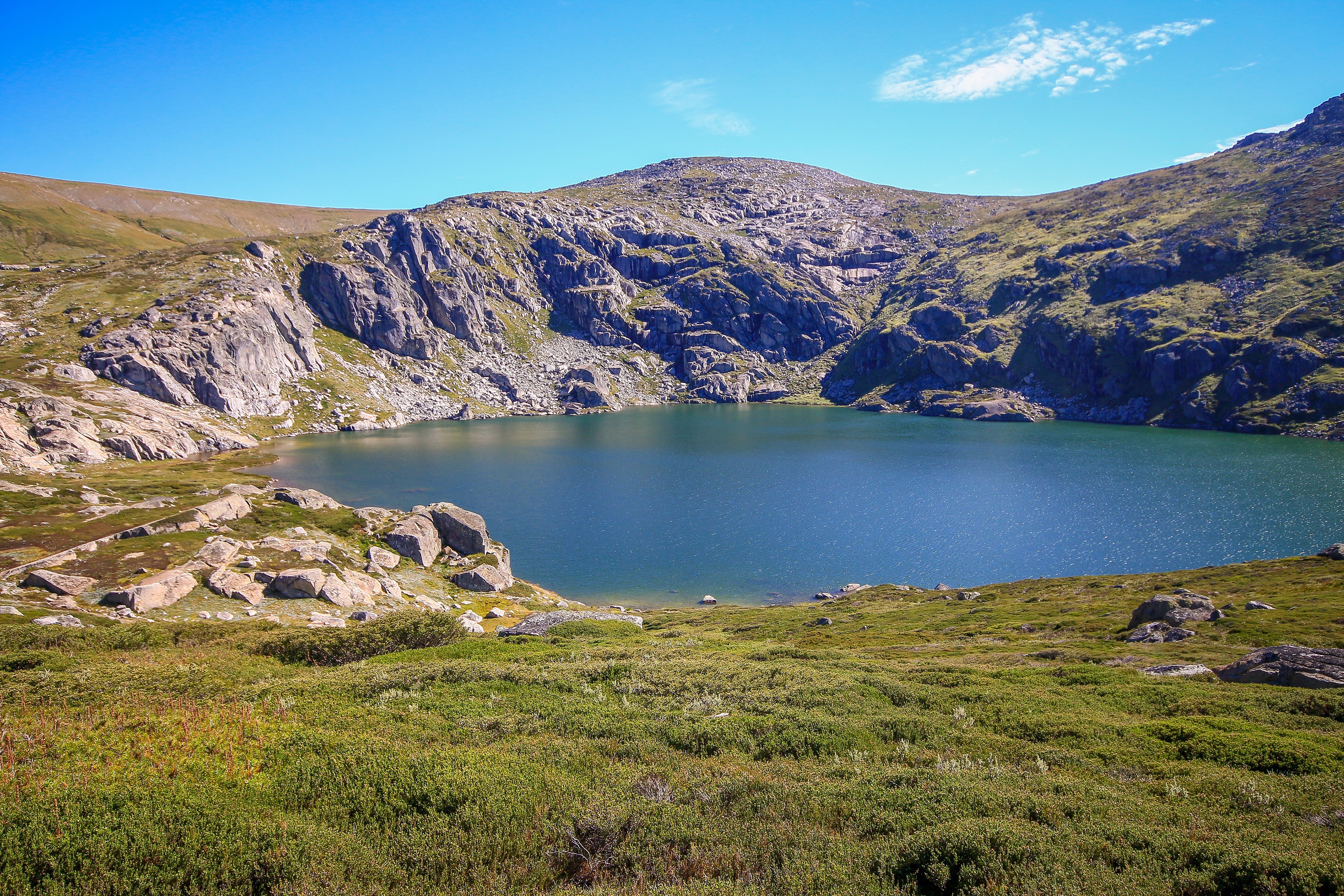
It is a good job life is sweet because there follows an incessant drag uphill and the prominent hulk of Carruthers Peak (2,145m) still seems a long way off. Along the way, the view down to Blue Lake offers a break and not long after the trail reaches the point at which the landscape plummets dramatically over the other side. It is a spectacular view, heightened by the big reveal as you come over the rise.
It is at this point that the Main Range trail veers left, and you can trace its outline steepening up to the lofty heights of Carruthers. To the right, an old, faint four wheel drive track is not promoted but neither is it barred. My research tells me this leads towards Mount Twynam (2,195m) and while I may not make it that high, I can at least aim for a rocky outcrop closer by.
There, mosses and flowers and hills upon hills upon hills stretching into the distance. Among these hills, the nearby Mount Sentinel stands out as the most jagged, traditional-looking mountain. This could be discovered one day too, but I would like someone else to come along for the ride, as a safeguard.
As tempted as I was to push on from this outcrop, I also figured I had reached my goal for the day with such epic vistas. I had also run out of sunscreen and broken my seven dollar sunglasses, so there was good sense in deciding to return before the day raced towards high noon. Good sense continued with a sandwich stop closer to Blue Lake, a baguette loaded with ham and brie beside a glacial cirque conjuring the pretence of France. C’etait la vie.
After such good sense at not being sucked in by the landscape at previous points, the sandwich gave me fortitude to have a nosy closer to Blue Lake. And then a faint track led towards Hedley Tarn before it simply vanished.
I spent a good 40 minutes trying to figure out a way back across to the Main Range trail, barely a kilometre away and visible thanks to its regular flow of people walking up and down. Encountering boulders and impenetrable shrubs I eventually resigned myself to retracing steps the way I had come.
All this extra energy consumed, and a sun now high in the sky, made me fearful for the final surge: the re-crossing of the Snowy and that godawful climb back up to Charlotte Pass. But in the end, it wasn’t so bad. The other half of my sandwich boosted the energy, and strategic photo stops offered necessary breathers.
While there is pleasure in an ending, those final stops proved bittersweet; captivated with the wild beauty and melancholy that it would soon be left behind. If it takes a pandemic to make me realise how special a place Kosciuszko National Park is, let’s please not have more pandemics. But instead let’s try and remember what it is like to cherish that which we had previously overlooked. Like Wales.
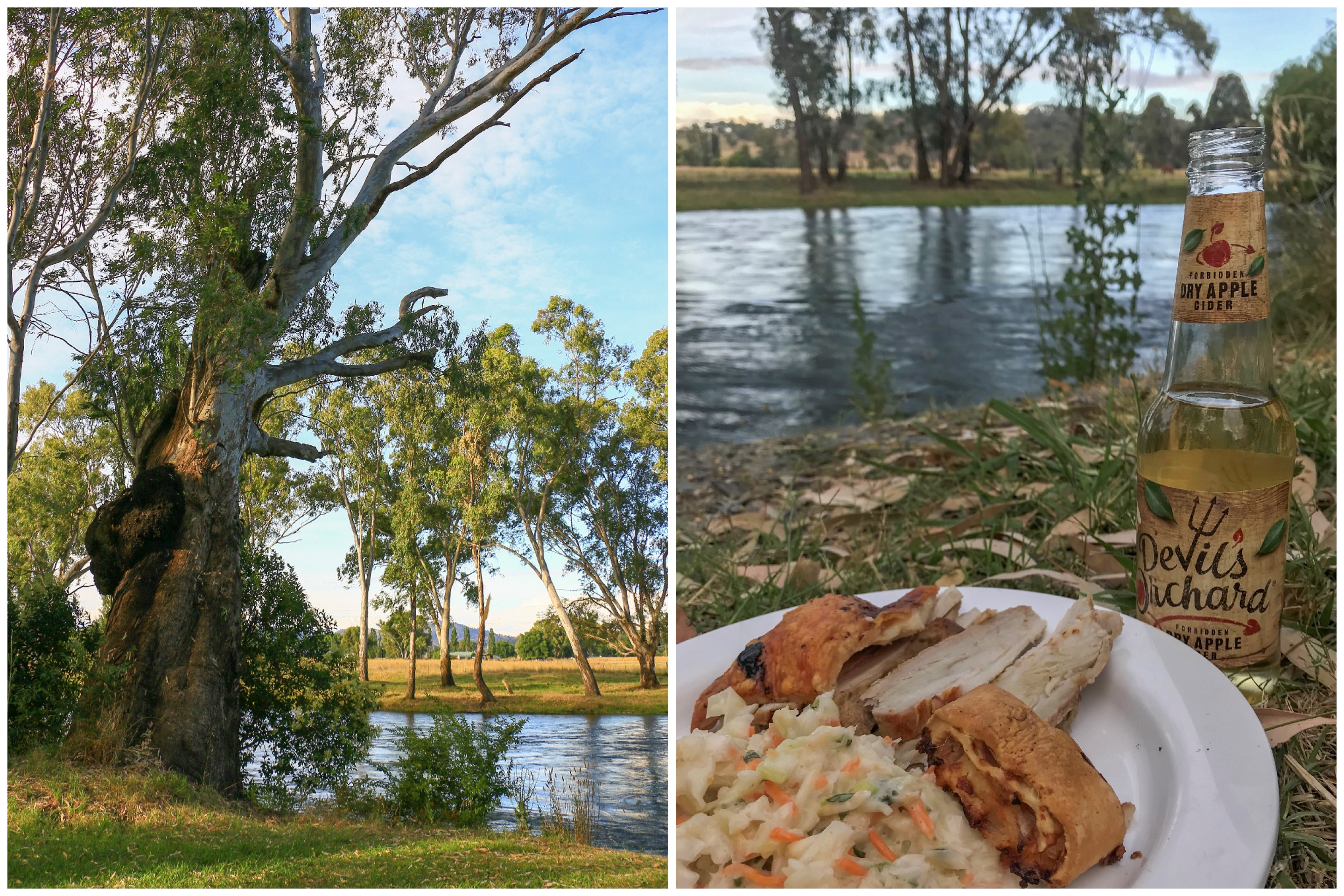
The Tumut River is proving a soothing spot. In spite of its swift flow, fed from the elongated dams of the Snowy Mountains, there is something becalming being upon its banks. Boasting more of an aquamarine shade than the sedimentary highways of the Murrumbidgee and Murray, it is a waterway begging to be paddled or fished. Or simply enjoyed from under the shade of a majestic River Red Gum – as long as you can overlook the fact that these trees have the pesky habit of randomly dropping their hefty limbs.
Various tributaries wind their way over fertile plains enjoyed by cattle and horses, mystery roads leading off into hidden valleys with panoramic landscapes. In Tumut itself, the river transforms what would be a pleasant enough little town into something more beguiling. Sitting among green parkland below the town centre, there may me a little part of water meadow England evoked. If you ignore the cackle of the cockatoos.
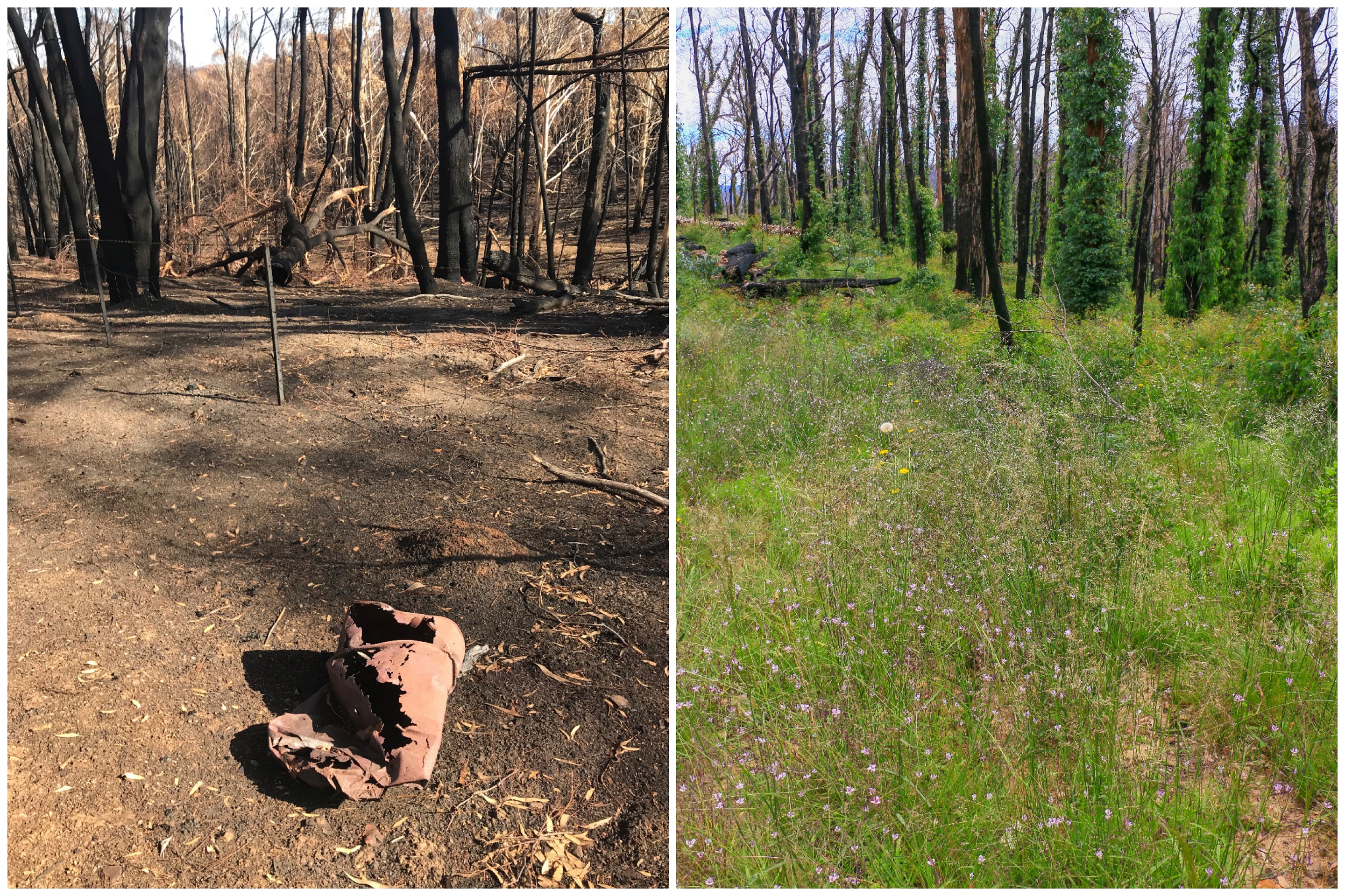
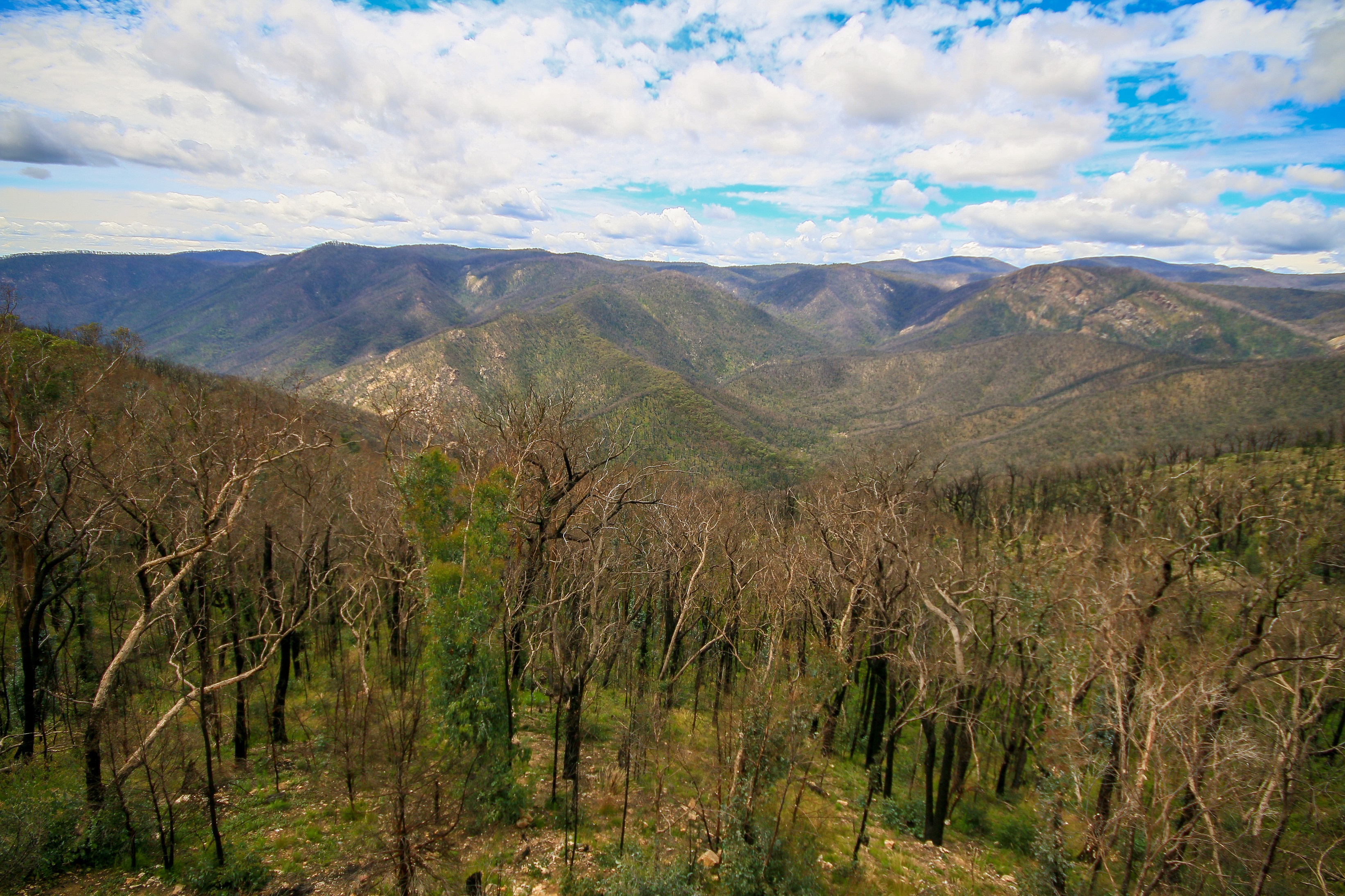
It was just under a year ago that I found myself here being rejuvenated after a day of hard labour pulling down fences in the hills behind. Sit in Tumut today and you would be hard pressed to imagine how fraught it would have been on January 4th, 2020. Approaching from the west, the Dunns Road Fire ravaged through Batlow and the Green Hills, cresting the Snubba Range and spilling down to and over Blowering Dam. It went on to merge with other large fires in the area, sweeping through pristine sections of Kosciusko National Park and the Snowy Valleys, before lapping at the edges of the ACT.
One year later I found myself in Pioneer Park sitting beside the river once again. It shows what an absolutely legendary year 2020 turned out to be that I had forgotten exactly where the fires had hit. No longer obsessively checking Fires Near Me I thought, for some reason, that the Dunns Road Fire had stopped on the western shores of Blowering Dam. Driving south from Tumut, it didn’t take too long to realise my oversight.
For sure, the western side of the dam is still quite a shock. Made up of plantation forest, the hillsides remain largely bare, apart from the blackened matchsticks of pine. Somewhere up there on the ridgetop, I wonder how Paul and Andrea are going on their farm, and whether Smiley has cheerily constructed a new hut. Hopefully the fences are still standing.
Down on the water, there is a somewhat normal scene of socially-distanced summer holidays playing out – all gargantuan encampments and four wheel drives and boat trailers. An emu pokes its head above the undergrowth, no doubt fleeing the meltdown of a toddler who just really doesn’t want to go anywhere near the water thank you very much. They seem to be everywhere.
Along the southern end of Blowering Dam, the impact of a year ago becomes clear as blackened trunks spread upwards to the east. There is regrowth, but it is thinned-out vegetation, revealing rocky, barren outcrops that probably haven’t been visible for years. Jounama Creek – a spot for camping and walking potential – seems less appealing than I expected, and I drive on.
From here it is quite the climb to Black Perry Lookout. Offering an impressive view out into the Bogong Wilderness, an information board makes it clear just how different things looked before the fires. In the picture, the peaks are still there, but cloaked in a swathe of lush green foliage like some kind of Jurassic Park. The picture also – frustratingly – features a much crisper, bluer sky than so far today. Both will come back, I hope.
The lookout is naturally a popular stop for trucks and caravans and trailers to catch their breath. One caravan seems to have had enough and the NRMA are being called. A clutch of potbelly bikers convey that menacing grizzled look that frequently becomes undermined by softly spoken, friendly chatter. One young guy appears anxious, on the phone to try and arrange a permit to access the ACT. Fire knows no boundaries and, for all we can try, neither does COVID.
My plan was to walk to a place called Landers Falls Lookout, lured by the promise of both falls and a lookout. It was either a ten kilometre there and back again or a swift 1.6km stop off from a four wheel drive parking area. I initially figured my car would be okay – it usually is – and inched down a big dipper of a rockfest. The way onward looked equally awful and – new year, no new words – I decided it was best to pivot. Back to the parking area for inadequate cars.
And so a longer walk ensued, but I’m glad about my decision. The car probably would have made it, but it might also have got two punctures, a broken exhaust, and a hazardous brake disc failure. Plus it was interesting and rewarding to tread quietly through this recovering forest, one year on.
What strikes you most in such worlds is the contrast between still very visible, jet black tree trunks and an overflowing understorey of grasses and shrubs and ferns and flowers. Where the two combine, witness the surreal procession of epicormic growth winding up into the canopy (before a certain pandemic, epicormic was probably the word of the year). The crowns of trees are still deciding whether or not they will come back, a process that will take more than just a year.
My initial fear that I would be sharing this walk with a procession of hoons in souped-up Hiluxes doing it the lazy way were unfounded. Probably because they don’t like to get their shiny blue paintwork dirty. Midway along one vehicle did pass, accompanied by the obligatory exchange of waves. Him thanking me for standing aside, me thanking him for the dust. At least there weren’t too many flies to elevate the experience further. Yet.
There was, in fact, a peacefulness in the forest. In patches the silence was punctuated by gentle birdsong – apart from the easy to spot pair of Rosellas, mostly this heralded from those little indistinguishable critters that hide in the undergrowth. Occasional rustles in the grass signified a lizard or bug or potential snake. I felt a bit more accepting of a snake sighting today, thinking it might liven things up. But it never happened.
This is not without giving the snakes ample opportunity, regularly veering off track to snap pictures of grasses and logs and flowers.
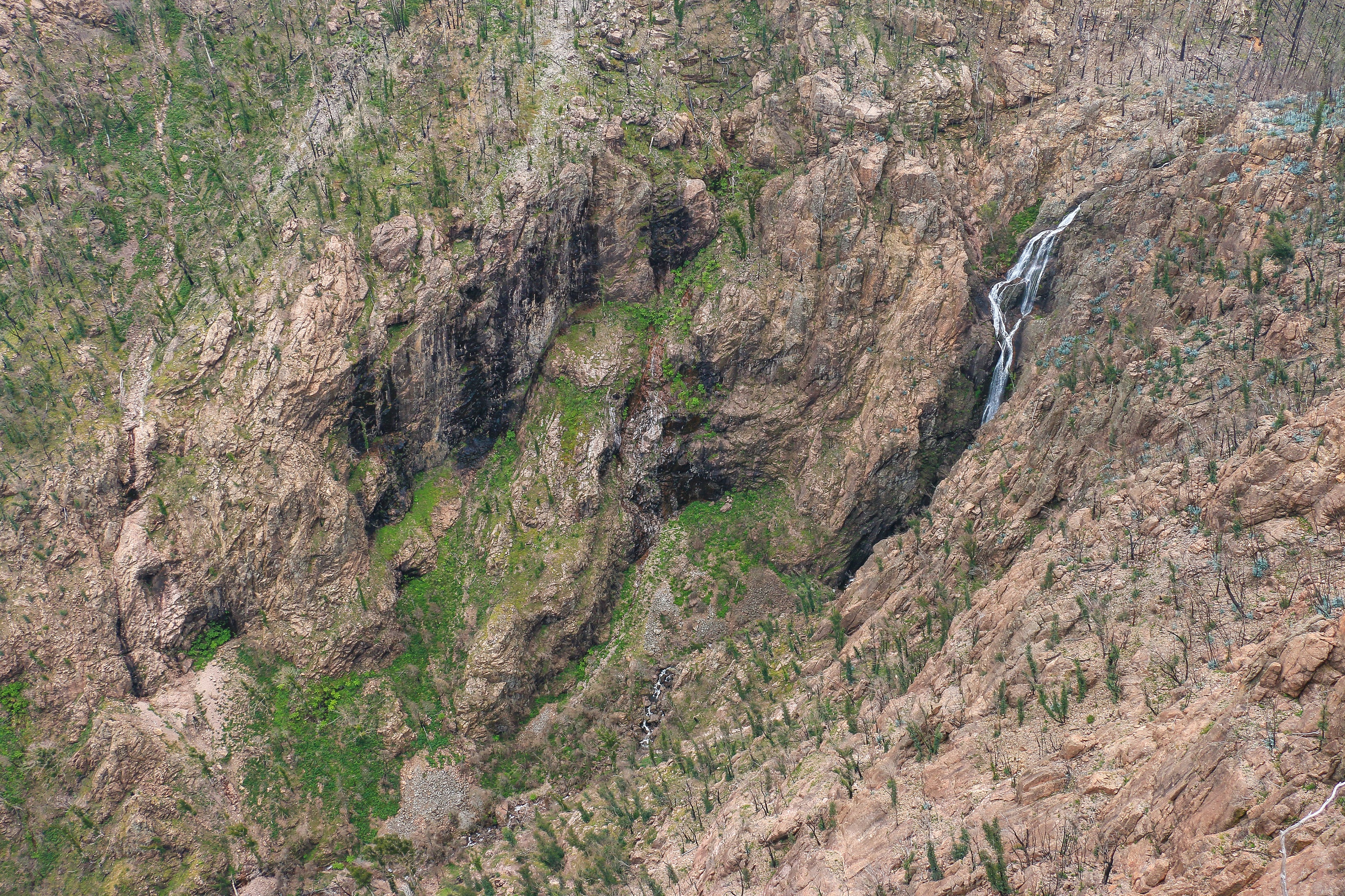
From the 4WD parking area, a non-vehicular route leads over Landers Creek and up towards a couple of lookouts. The sound of running water was a good omen for the falls, as was the vertical climb for a vista. Away from the creek, the undergrowth rapidly diminished, replaced by bare rock, charcoal logs and gravel. Exposed, barren, humid, the perfect time for the flies to welcome me in droves.
I deleted several shots from my camera because of photobombing flies. When you get a clear shot, the first lookout offers panoramic views towards Talbingo Dam, the course of the creek winding down towards its shores. In the near distance, a second lookout appears even more precariously perched upon a towering outcrop.
At this second vantage, the falls become visible and form quite an impressive drop, even in the relative dryness of summer. The landscape is an otherworldly array of arid browns and fluorescent green, the steep hillside opposite lined with black spikes like hairs standing to end. The aerial perspective from this vantage is mesmerising and I enjoy it with a cold pork and pickle and fly sandwich.
Lingering for a while allowed me to pick out some of the minutiae: individual tree trunks clinging to a rock face; coils of epicormic growth leading to barren white crowns; cliffs streaked black; a cluster of ferns glowing luxuriant in a hollow. It was as if I was Google Earth or something.
Lest I get a godlike complex high above, I managed to get a little lost on the way back down. I find every rock and burnt log looks pretty much the same. But following the creek I found my way once again to the 4WD car park and onward much further to my own car. Nearing the end of the trail I passed a family with three kids setting off, satisfied that I’m not the only one with an inadequate vehicle.
Back in civilisation it was very much that time of the day when ice cream is mandatory. Civilisation is hard to come by, but the small township of Talbingo offers one of those amazing supermarkets that sells everything from tinned food to drill bits to crates of beer to chiko rolls to two year old editions of Angler’s Almanac. It also houses the post office, tourist information centre and a photocopier. Though lacking gourmet ice cream, a Honeycomb Maxibon on the shores of Jounama Pondage provided sufficient sustenance.
Ignoring the burnt trees on the other side there was a touch of the Lake District in the grassy foreshore and rounded hills disappearing off into the horizon. Blue skies and fluffy white clouds completed the Wordworthian idyll. Again, a year ago, Talbingo was far from it.
From English lakes to Spanish sierras, a journey of disastrous superspreading madness only now restricted by fanciful wartime yearning to regain a supposedly lost independence. Here, the European mirage took the form of a solitary, short drive down the road towards Talbingo Dam. On one side, a panorama of barren ridges and spindly trees, dusty earth and searing sun. A glass of Rioja and a siesta would go down well, but I must move on.
The dam itself has the requisite boat ramp where the road terminates. Here, a wide gravel parking area was solidly packed with trailers and those four wheel drives so suited to the walking trails around this way. A regular flow of vessels with names like Crusader 3000 and She’ll Be Right were being lowered into or dragged from the water. Outboards buzzed and jet skis thrashed and bins were overflowing with the remains of picnics and beers. Behold the domain of the boatpeople.
I was planning on camping in such an environment, albeit further north on the shores of Blowering Dam. But throughout the day there was something going on in my head looking for excuses to get out of it. Heat building. Risk of storms. Boat people. Perhaps the final straw was the realisation that I had left my salad in the fridge at home and would have to resort to a dinner of cold pork and disappointing pastry. I could survive, but would it be worth it?
Procrastinating around a greener, untarnished landscape with views to Blowering Cliffs, I figured I could drive into Tumut and procrastinate some more, while also picking up salad to complicate the decision-making process even further. If I had made a New Year’s Resolution to be more decisive – which I hadn’t – I would have failed already – which I didn’t.
Tumut was just that little bit closer to home and I was willing to embrace a two and a half hour drive into the evening, weighed against the likelihood that I would struggle to be sleeping anyway if I was to stay and camp. Hot water, comfy bed, a flushing toilet v lumpy mattress, strange noises and a long drop. Next time I head off with the intention of camping I need to exceed at least a three hour radius from home.
Je ne regrette rien, as they say in the aisles of Tumut Woollies, for not only did I manage to get my salad fix (albeit in the form of calorific coleslaw), but I also finally snaffled a half price Christmas cake. And then I took to that riverside, wandering and eyeing up future opportunities to explore before settling upon a delightful dinner spot.
There are places I’ll remember. Soothing. Becalming. Rejuvenating. Nourishing. Like a shot in the arm.
Usually a work trip to Wagga Wagga would trigger at least an eye roll and a quiet sigh. Another country town with no obvious attraction and dubious coffee. A trawl along a quiet highway surrounded by sun-parched nondescript land. Oh, and the prospect of work at the end of it all.
But, this time it was different; I was mildly enthused about the prospect. Partly this was about getting in the car for a decent drive for the first time in a while, stopping at random road stops and revelling in the golden expanse of country New South Wales. Then there was the understated, hidden gems of Wagga to discover, aided by a little expert advice. I might indeed get a good coffee. And the work? Well a necessity, but it was perfectly reasonable to manage.
And so the drive out of Canberra almost immediately led to immersion into a flat, golden brown landscape almost devoid of interruptions or scenic highlights. Diverting around Yass and Jugiong and encountering extensive lane closures on the road to Gundagai, distraction naturally came with the Dog on the Tuckerbox. It’s a statue of a dog. On a tuckerbox. But it is sunny and warm and the landscape here more undulating and fertile. Gum trees offer shady refuge for the melodious magpies and chirpy galahs; tin sheds and wooden farmsteads sit snugly among long grasses and fields of sheep; and there are numerous comings and goings to observe at the Tuckerbox KFC.
Shortly after, the Sturt Highway commences on its way to Adelaide, with Wagga just a short stretch along the road. Loosely following the Murrumbidgee River valley, it’s a pleasant approach before the surprisingly elongated suburbs of Wagga arrive in the form of an airport, tractor supercentres, and Red Rooster. It’s a bustling kind of place and – like many a country town – appearing to self-sufficiently prosper in the midst of nowhere.
I enjoyed a late afternoon beside the river, checking out the sandy beach and colourful language of some local ladies engaged in a very open discussion about Tinder and uncles marrying strippers and the like. The beach is obviously no Bondi or Bantham, but there’s sand and water and – I can imagine on those scorching summer days – it has enough going for it to impel you into the Murrumbidgee. Under the shade of eucalypts the vibe is chilled, languid like the river itself and I could have sat here a while if I didn’t have some work to do.
The next day I said farewell to Wagga but not before a very good coffee and breakfast at Trail St which means that the city can now enter the pantheon of places that earn the ‘I could live here if I had to’ badge of honour. If I did live there, maybe the staff at Trail St would be a little less cold and engage me like they do all the regulars, rather than as someone from out of town who might just be there to write about them on Trip Advisor. Which I wasn’t. But hey, you’ve made it to a blog that no-one reads! Oh, and while I’m plugging stuff, eat or get takeaway at Saigon, just because okay.
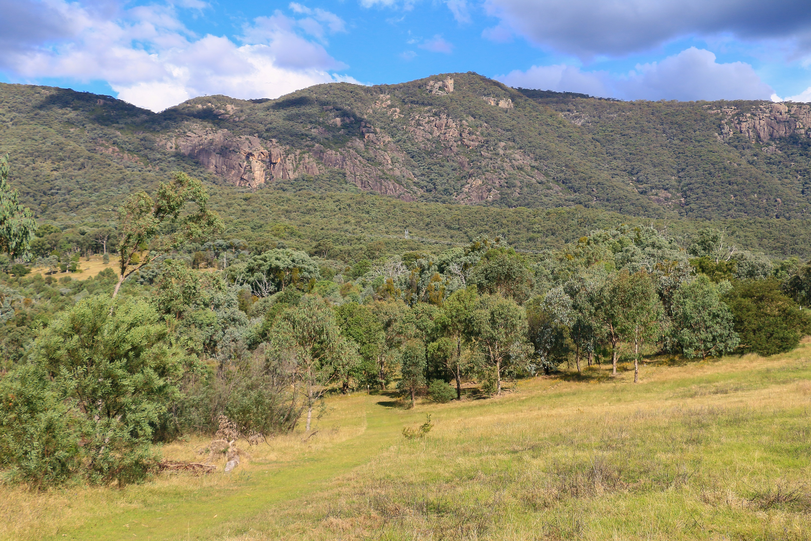
The return trip was far more diverting than a dog on a tuckerbox, mainly because I opted to take a different route back which didn’t involve dual carriageway and bypassing one street towns. The Snowy Mountains Highway stretches all the way down to Cooma, and if I was going to avoid taking a massive detour to Canberra I would have to find my way across the Brindabella Ranges. But first, time for a little bushwalk, just south of Tumut to a slab of rock called Blowering Cliffs. It was a decent jaunt out, starting off through lush meadows and rising ceaselessly through forest to a protrusion of granite. Sometimes a waterfall plunges off here, but today it was like a sporadically dripping tap.
Back in Tumut I was surprised at the size and positive signs of life in evidence. It is not entirely clear why Tumut exists but, just like Wagga, there was a modest elegance and reasonable hubbub to the town centre. Here there is not just one main street, but a whole block, complete with dubious looking cafes and country stores selling hats and water pumps, at least three pubs to kill time, a McDonalds and – unbelievably – both a Woolworths and a Coles supermarket. Tumut, bigger than you think, was not the sign I saw as I left town with a McChiller Chocoffee in my cup holder.
The road heading towards the Brindabellas and – eventually – the ACT border was a pleasant surprise, at least to begin with. Indeed, it was rarely boring, transitioning from a beautiful pastoral scene following the path of a narrowing ravine into sweeping forested hills. The hills were all plantation pine and there was the constant thrill of the potential for a massive truck chock full of logs hurtling at you at 120 kph to keep you awake. This was all on sealed surface, but after the forest it inevitably gave way to loose gravel to dirt to rocky lumps descending precariously down towards the Goodradigbee River. And what a veritable Eden this spot was, a verdant paradise of a valley between the hills.
What goes down must go up and so there was some further climbing through Brindabella National Park on more precarious surface before cresting the ranges where the NSW-ACT border sits. I figured out this was my final road border crossing into the Australian Capital Territory and immediately the road surface improved: still dirt but smoother and significantly more tolerant. At the oh-so-ironic Piccadilly Circus I was back on familiar ground, winding down towards the subdued hum of sealed tarmac once more. Back in Canberra comfort, but with the satisfaction of a touch of exploration behind my back.
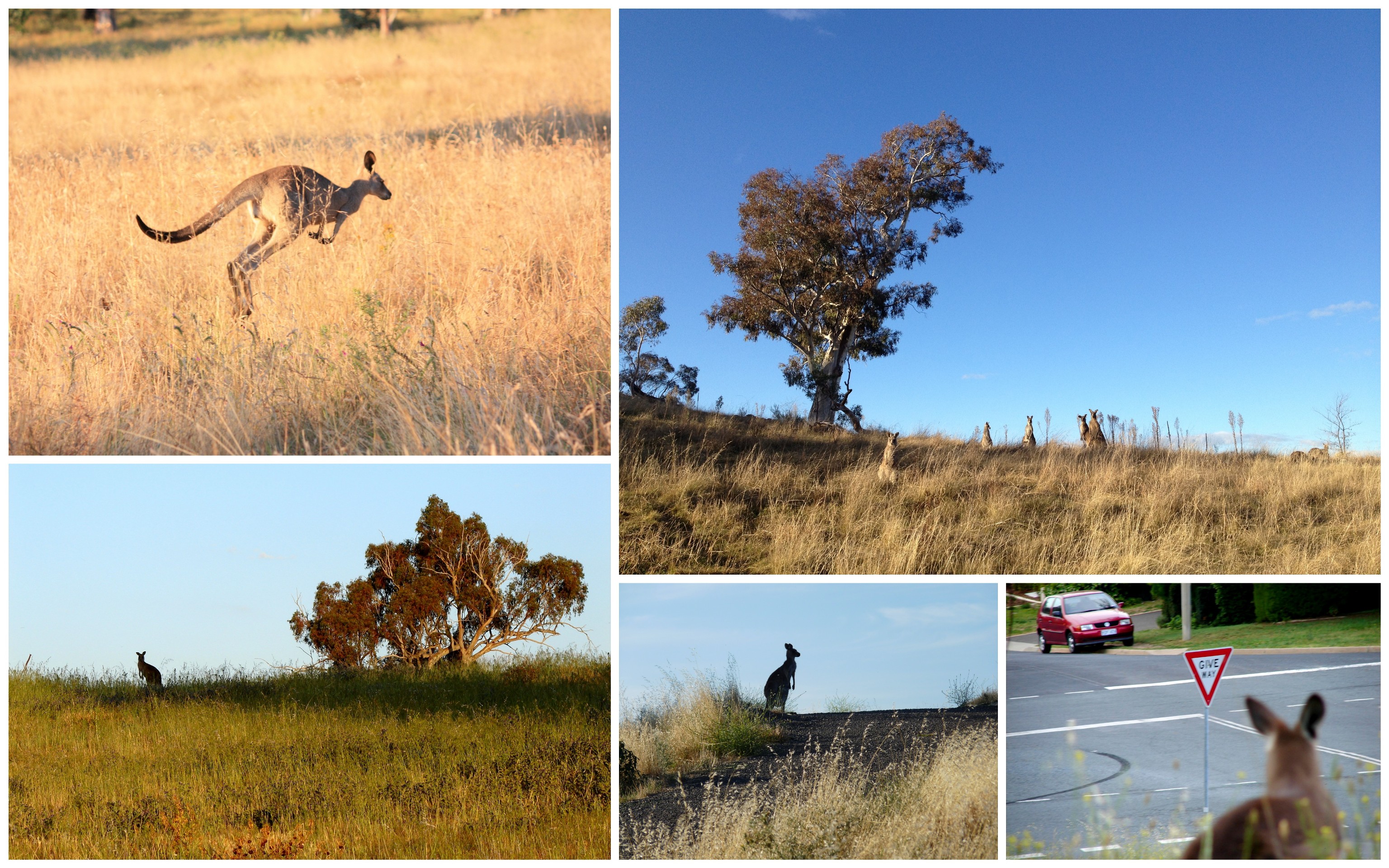
Just over the hills yet far away there is a landscape of sweeping upland plains, forested ridges and snaking river gorges. Wild Brumbies gallop gracefully across the grasslands or socialise under the shade of a clutch of gum trees. Kangaroos on a family outing peer up out of the golden tufts, looking fairly nonplussed about it all. Cockatoos predictably shriek and magpies chime sweet melodies. The skies are big and low and can almost be touched.
The Cooleman Plain is about 50 kilometres from downtown Canberra, as the cockatoo flies. For us humans with four decent and independently operating wheels, it takes about 200, detouring south to pass round the Brindabella Mountains. The ride is scenic heading down the length of Namadgi National Park. The border crossing into NSW is modest, marked more strikingly by a deterioration of road surface than anything else. And then the joy of tarmac in Adaminaby is only eclipsed by the sight of the Big Trout.
Other than a giant fibre glass trout there is not much to distract in Adaminaby, so you head promptly in what seems to be – finally – the right direction. Kiandra – an abandoned high country settlement spurred on by gold – sits bleak amongst boggy plains and barren ridges. There is a touch of upland England in the vista, that same sparse striking beauty available in the high parts of Dartmoor or the Peak District. But the gum trees tell you this is unmistakably Australia, as you head down into the sheltered green valley housing the Yarrongobilly Caves.
I have been here before, but that was almost ten years ago. Almost ten years, when I first arrived to live in Australia, intending to stay for a year! I couldn’t remember much of it, though the giant hole in the ceiling of one cave opening triggered something approaching recollection. But the river walk must have been new, at least for my feet, and the thermal pool – a steady 27 degrees all year – offered surprise and consideration for wintertime lolling.
Back up the chasm and across from Yarrangobilly, the upland plains stretch out north and east, interrupted occasionally by hilly islands of trees and the long barrier of the not-so-distant Brindabellas. I am heading towards Canberra again and almost expect to catch a glimpse of the needle tower on Black Mountain. But of course I don’t, the high peaks of Bimberi, Gingera and Ginini standing in the way. I have been up there, and it seems oh so close.
By now the day is moving towards an end and there is a wonderful aura in the light, filtering at an angle onto the grasses and gums of the Cooleman Plain. Keen to take a walk in this golden hour I follow the dirt road towards the remnants of Coolamine Homestead. There is no-one else around and I daresay the Brumbies are more attuned to seeing cars hurtling past than humans gently ambling. A couple seem protective, endlessly circling, snorting, staring me down in an effort to keep me away. I am wary but they allow me passage.
Coolamine Homestead is one of many that dot the highlands within and around Kosciuszko National Park. Practically all are now abandoned, the toil of work and life in such isolated and unforgiving climes proving too much to sustain. Coolamine is at least restored and, with this, promises a certain cosiness and tranquillity, at least on such a beautiful March evening as this. But you just know the winters will be harsh, the life lonely, the work unviable. Plus there is no mobile signal to be able to do anything whatsoever, a sad indictment of modernity that I resentfully find challenging now.
At nearby Cooleman Mountain I set up camp for the night without any signal, without any other people, without the comfort of civilisation. It is perhaps because of this that setting up mostly involves shifting things around in my car to accommodate a swag mattress. For some reason I don’t fancy sleeping outdoors – the remoteness, the impending chill, the inevitable, sopping morning dew. The cocoon of the car feels protective. I’m not entirely sure watching an episode of The Walking Dead on my laptop in the dark shell of my car in the middle of an empty forest without anyone else nearby is smart. But I do anyway, and no zombies bang on the window during a fitful night’s sleep.
Age must be affecting me because I am questioning the sanity of camping, even if I have copped out by reverting to the back of the car. Every little thing requires pre-planning and organising, extra time and increased awkwardness. It is effectively homelessness, perhaps more so when you sleep in the car. But then, in the morning, as the misty murk of pre-dawn is dispersed by a welcoming sun, as the deathly still air fills with birdsong, as the wattle and grasses shimmer silver with dew, as you witness the birth of a new day a part of this nature, you know why you do it.
The pre-dawn murk took a little longer to clear down in the plain, and shifting my car back to the homestead required slow and steady navigation through the mist. Setting off from here by foot I resumed my journey along the dirt track towards Blue Waterholes. Ever closer to the ACT border, the mist quickly lifted to show off the backside of the Brindabellas and then, before them, the steep-sided river banks and gorges which filter water down to the very fish-friendly Goodradigbee.
It is, in theory, possible to clamber your way to the Goodradigbee, but this seems almost as difficult as pronouncing it. Beyond the scenic Blue Waterholes (which enjoyed relative popularity and happy interaction with fellow humans), river crossings and the narrow pass of Clarke Gorge make it too much for someone who is already warm and weary, and has been told to beware of snakes in happy interactions with fellow humans.
Luckily, Nichols Gorge is more family friendly but I daresay unlikely to be any less suited to snakes. I didn’t see any in the end, which is surprising given the many heated rocks of the dry creek bed and the tumbling gorge walls. The walk is pleasant, though today it seems to drag a little. The surroundings certainly offer something distinctive: with a tinge of red and a few more eucalypts it could be within the cherished Flinders Ranges. Not just across the border from the ACT, tantalising close to views of the Black Mountain tower.
Of course, getting back to see the Black Mountain tower requires a three hour drive and, as I launch up from the gorge and back out onto the unprotected expanse of Cooleman Plain, I reward myself with a cheese-filled baguette, true mountain walking food. This will keep me going until Adaminaby, where I can pause and refresh with a giant trout. And that will nourish enough to rumble along the dirt, across the border and over the hills, back to a place not really very, very far away. At least as the cockatoo flies, or, indeed, as the Brumby gallops.
In another week in which the Australian political landscape imploded in much self-generated excitement, it is hard not to be drawn into contributing more electronic graffiti about levels of douchebagness and the chaos and disorder that is certainly not happening again like it did with that other bunch. Nothing to see here, move along now. However, while the world really doesn’t wait with baited breath to figure which “adult” is in charge of the Knightly Order of Her Majesty’s Commonwealth of Australia, the natural landscape is in much less turmoil (unless you listen to those wacky “scientists” with their corroborated, peer-reviewed “research” and years of undisputed empirical “data”). There are, clearly, mountains to climb and some are easier than others.
The Snowy Mountains are very old – older indeed than a snoozing Senator – and have been worn down over millions of years. If they were several millions of years younger they would be more akin to the New Zealand Alps or the Himalayas, but because of their age they have mellowed; they are more rounded, worn down and weather-beaten, skin baked by summer sun and scoured by winter ice. They are, perhaps, the Brecon Beacons down under, with classic U-shaped valleys, remnant moraine and small, glacial tarns.
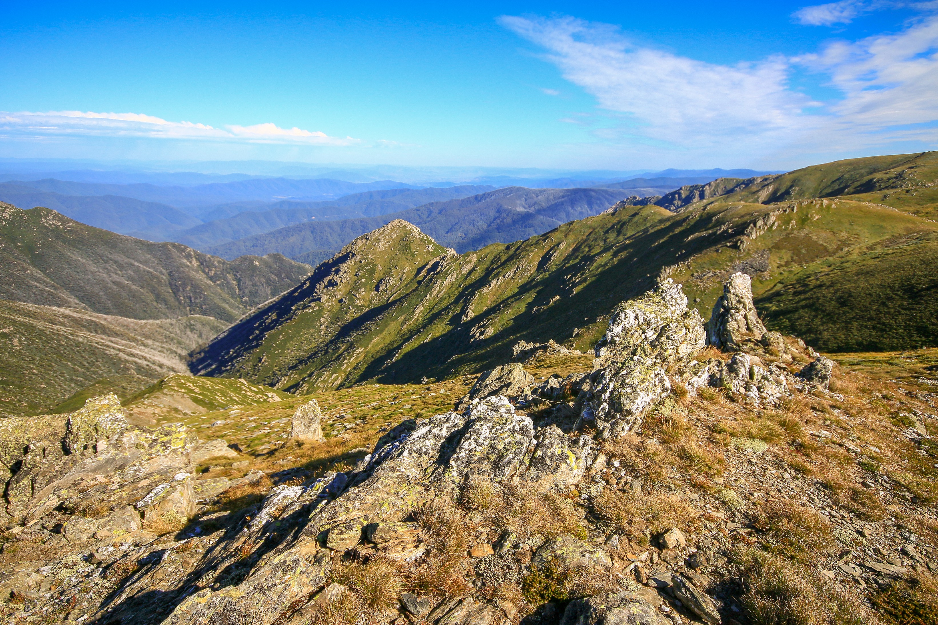
Having digested various parts of the mountains over the years – embedded deep within Kosciuszko National Park – a one-day walk finally appeared to stitch together the different threads of footsteps past. In particular, the Main Range circuit, nudging 22km in length and looping around the highest country. This included a stretch of six kilometres or so that I had not been on before and which, undoubtedly, was the most spectacular.
So, in pursuit of clear air and with the captain’s picks of two friends for company, let me guide you around the trail in a mostly factual, pictorial and certainly not chaotic or disorderly fashion…
Starting off from Charlotte Pass (1,837m), the track drops substantially to ford the Snowy River (1,717m). The river rises somewhere amongst the boggy marshes 5km upstream, and has gathered enough water by this point to make a crossing on stepping stones sometimes hazardous. Today – still reasonably early on a crystal clear February morning – all was rather placid and safely negotiated without wet feet or soggy sandwiches.
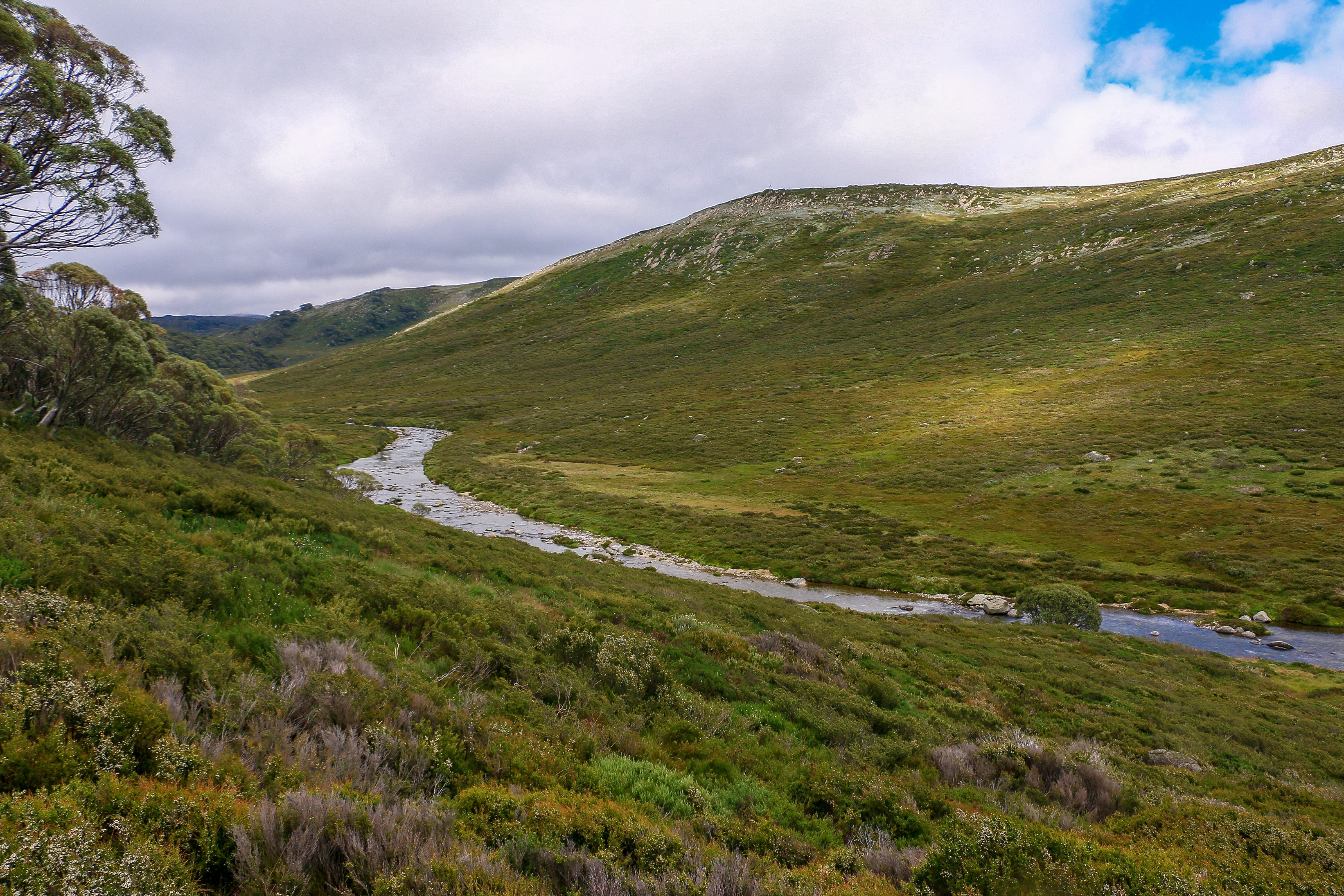
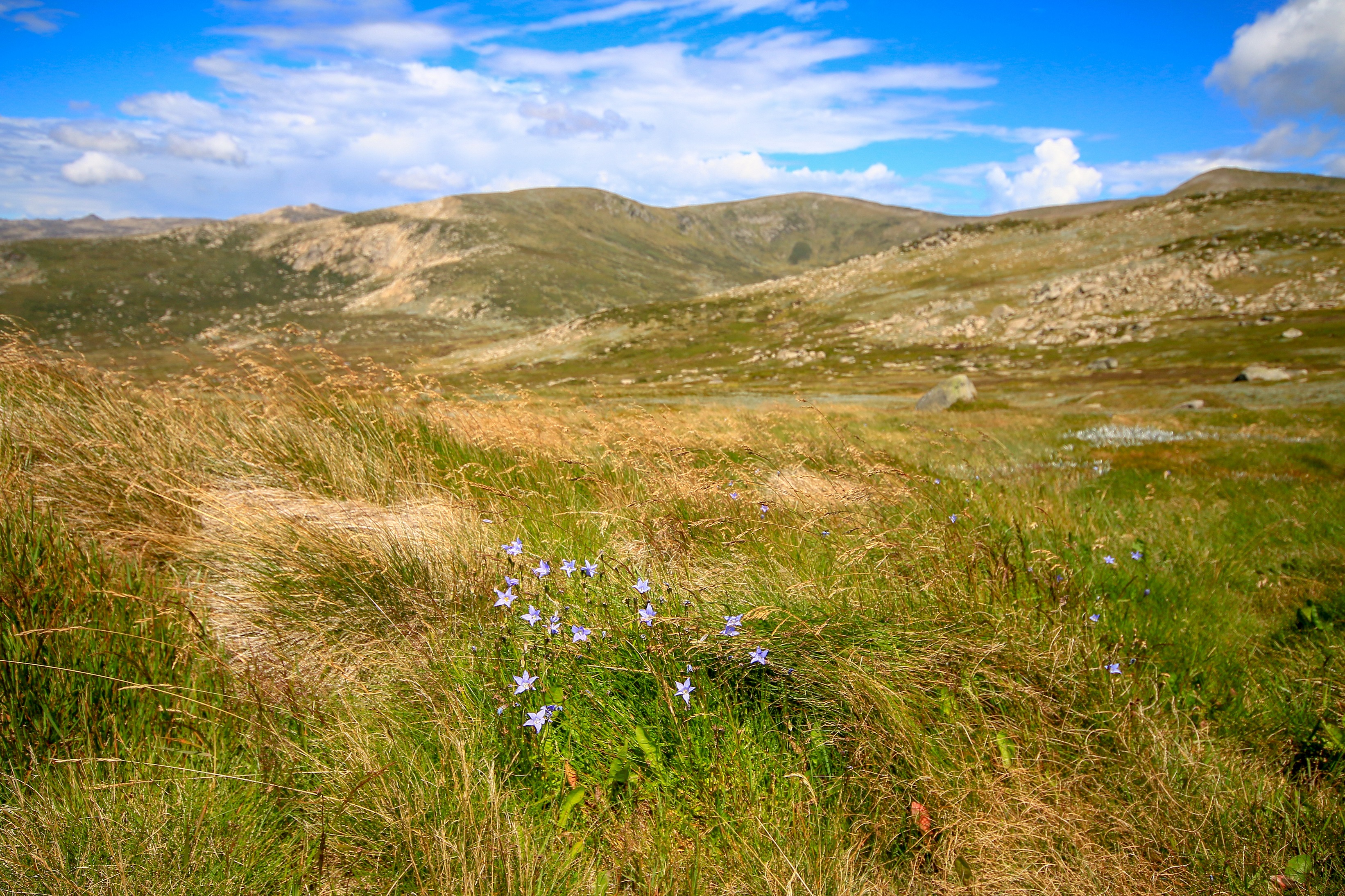
From the river crossing it is unsurprisingly onwards and upwards; in fact the climb, while never too steep, is quite incessant and longer than I remember! However, with altitude the views start to open up, including the sight of Hedley’s Tarn and the ridgelines of the Main Range’s highest peaks.
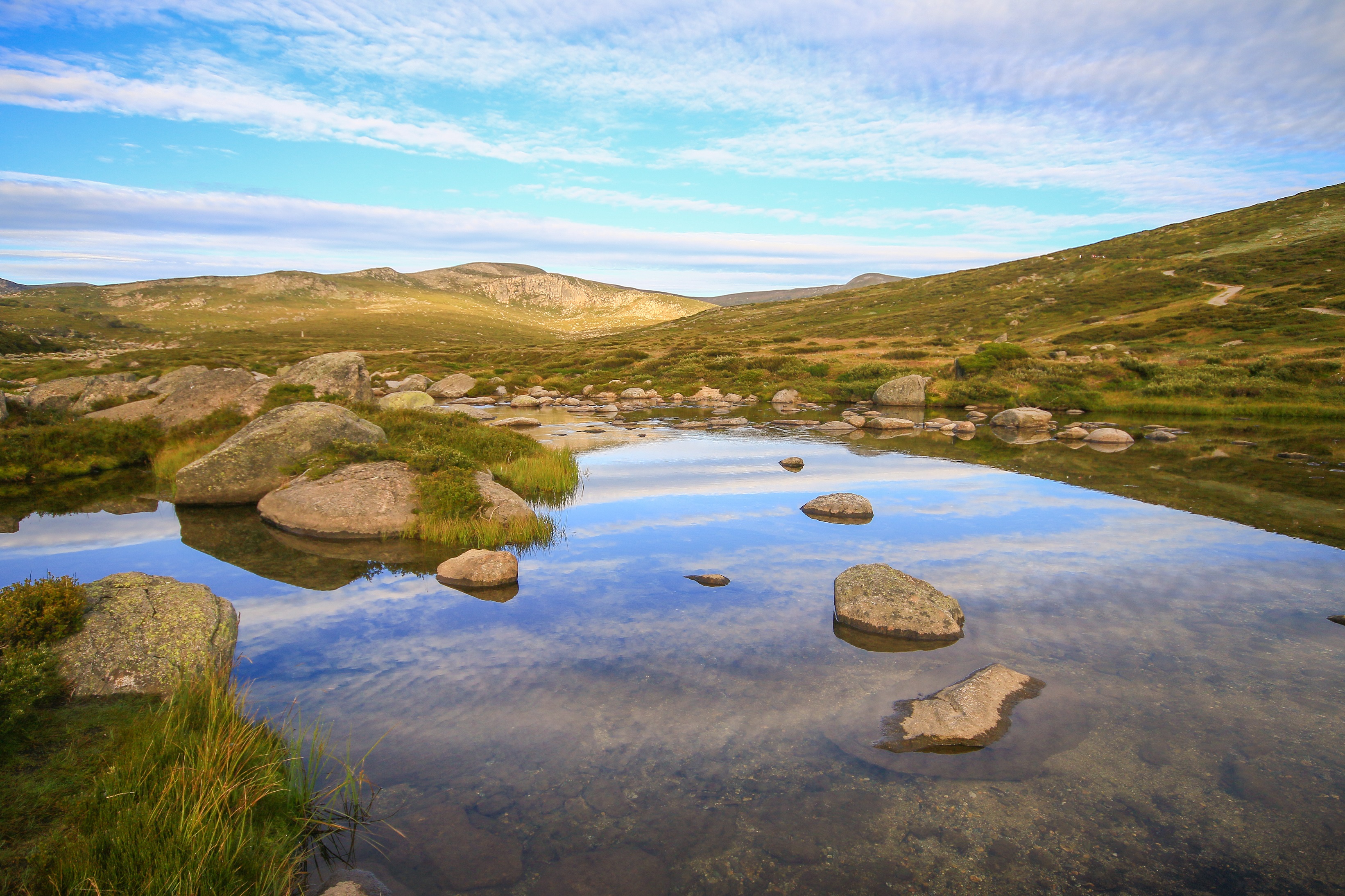
After some 300 metres of ascent and four kilometres from the start a view of Blue Lake is attained. Today it is lacking much of a blue colour and the glaring morning sun and a wind whipping across the surface are photogenically challenging! From here though it is not too much further to reach a saddle with the first views of more spectacular jagged mountains and the ranges of blue spreading west. A perfect opportunity for a morning food stop taking in a homemade sausage roll and spot of middle-class hiker’s quiche.
From this point, the trail is all new ground for me and the morning sustenance is useful for the slow climb up to Carruthers Peak (2,139m). The spectacular views continue, and the summit itself affords the first look at Club Lake, as well as the trail following the ridgeline to the rather bland summit of Mount Kosciuszko.
The ridgeline is a joy to follow, with remnant wildflowers, the prominence of Mount Townsend to the right and deep ravines carved by Lady Northcote’s Creek, the mountains seeming to tumble sharply west. I have no idea who Lady Northcote was but if her character was anything like that of the landscape in which she was named, she was probably a bit of a looker, though occasionally bleak and somewhat cutting.
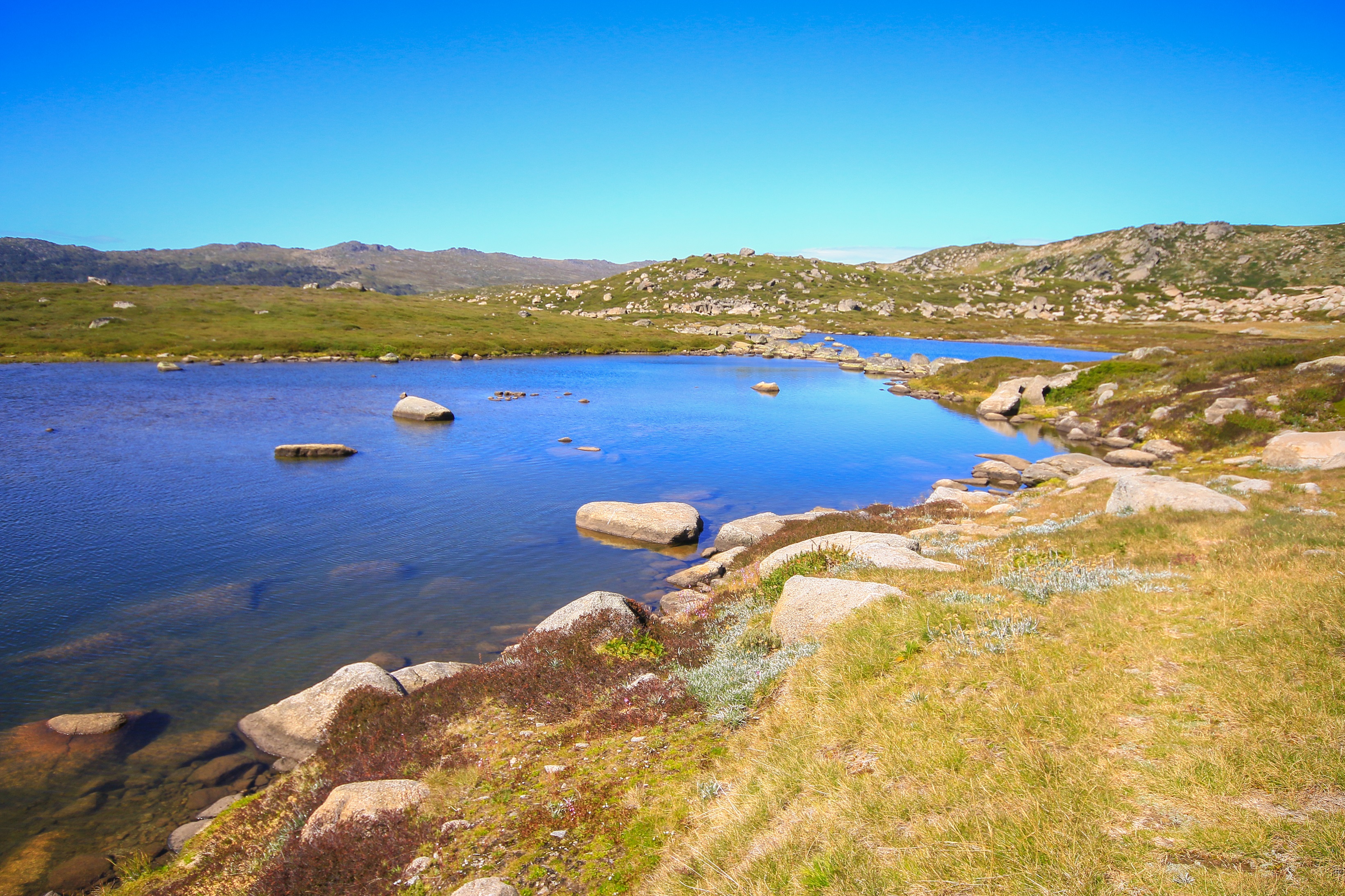
Before too long Albina Lake emerges, tucked in a sheltered valley seemingly conducive to an array of wildflowers and other alpine plants. The lake looks quite inviting in the warmth and would prove a nice spot for a picnic. It’s about nine kilometres into the walk now, and with the summit of Mount Kosciusko just a few thousand metres distant, we resolve to head on and join the masses carrying their lunch to the top of Australia. On reflection, the best part of the walk is over…though this may be in part because familiar paths will soon be rejoined.
Unfortunately we seem to have gradually descended a little, and the hoick up to the main summit thoroughfare is probably the steepest of the day. We’re not talking rock climbing here, but frequent steps and, by now, quite a penetrating sun. The junction with the main summit trail is like emerging from a country lane onto the M1. Mostly originating from Thredbo, families, fitness freaks and old fogies join us in a steady stream coiling up to the top (2,228m). A medley of Aussie flags and fluoro leggings congregates around the summit marker, and lunching is de rigueur. With homemade hummus and more quiche ours is perhaps one of the more pretentious of picnics!
Apart from a little blip it is all downhill from here, some eight and a half kilometres back to Charlotte Pass. From Rawson Pass (2,119m) – which is something akin to the base camp for the summit climb and apparently includes Australia’s highest public toilet – a sedate, well-graded trail makes it all the way back. This is the old summit road and I read that a shuttle bus used to ply along here, part of me wishing it was still running. The open scenery is not unpleasant, but in comparison to other parts of the track and given the gathering weariness this part is a bit of a drag. Markers every kilometre break it up, as does Seaman’s Hut (2,020m) and a more comfortable bridging of the Snowy River with four kilometres remaining.
Approaching Charlotte Pass, signs of civilisation re-appear – a chairlift and the occasional dark grey metallic huts populated by visitors in winter. The Snowy courses to the left and from across the valley the earlier, upwards trail to Blue Lake looks like an impressive climb! Snow Gums also cluster here, stunted and bending with their striped, smooth bark of chocolate and sand, of black and white. Afternoon clouds are building and the risk of storms hypothesised look as though they will be realised. But, after six and a half hours and 21.9 kilometres, we reach the (relative) safety of a Subaru Outback. Accomplished and relieved, invigorated and weary; trundling another 220km back to Canberra (577m), via Jindabyne caffeine and Cooma steak. From the real Australia and back to the bizarre.
I reckon every city and town and village and hamlet should have its own special ‘day’. It should be a time for locals to come together to take stock over what they have collectively achieved and to dream of what can yet be achieved. An opportunity to dress up for those from outside looking in, welcoming others into a collective ample bosom designed to make them say things like “Yeah, you know this really is quite a nice spot.” A symbiotic way for the place to provide something back to its inhabitants, made only possible by its inhabitants putting something into the place.
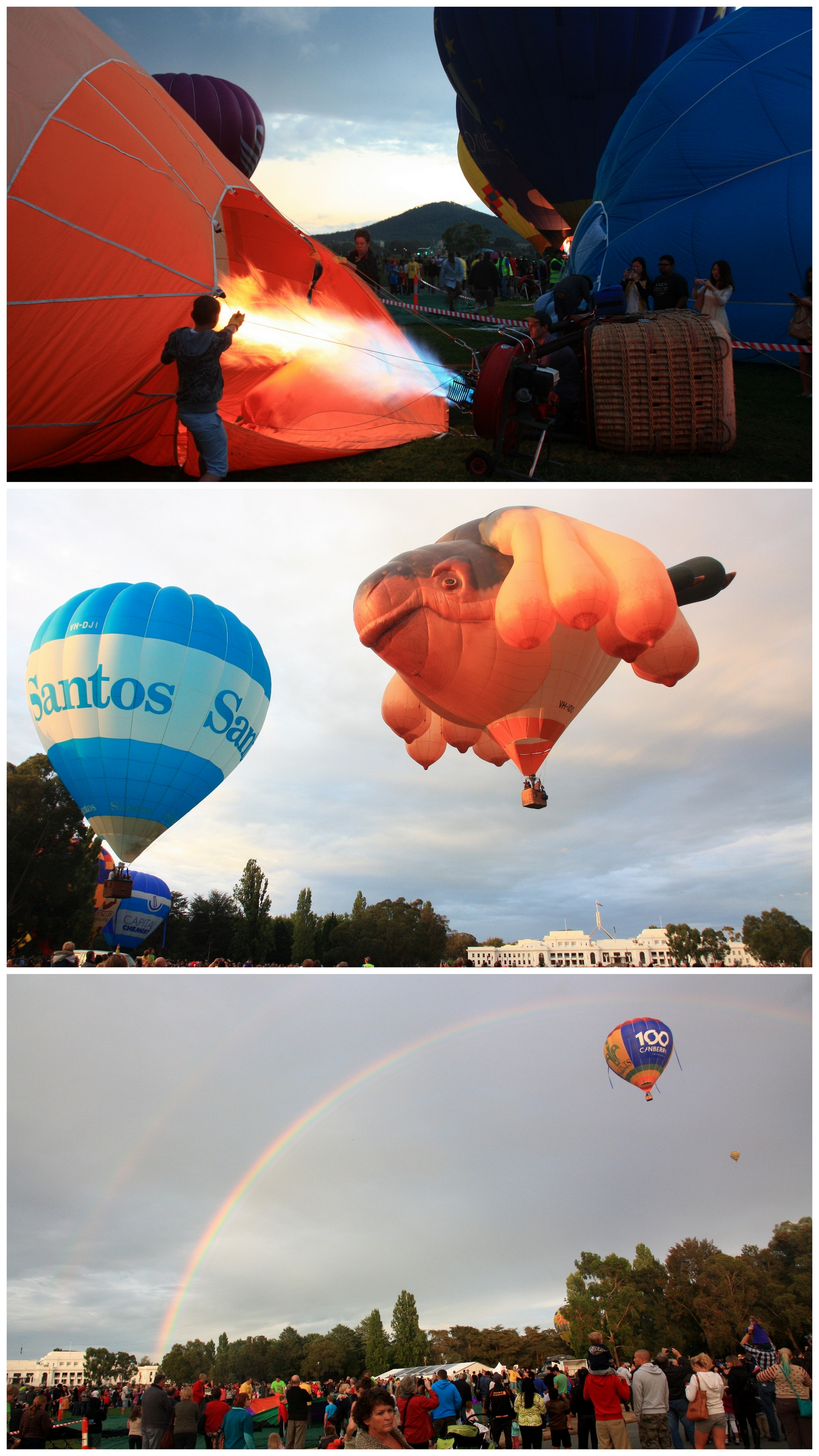
If Canberra Day is anything to go by, such extravagance is elongated over several weeks sometime around March. With the seasons commencing a transition, it is one final agreeable hurrah, a lingering celebration of another summer before thoughts of hibernation and exile set in. It is still warm but the days are shortening, making it an ideal time for pre-dawn balloon ensembles and post-dusk illuminations. You don’t have to get up too early or stay out too late, and you don’t yet have to risk strangulation in a melee of scarves and hats and fleece blankets because it has dropped to something arctic like ten degrees.
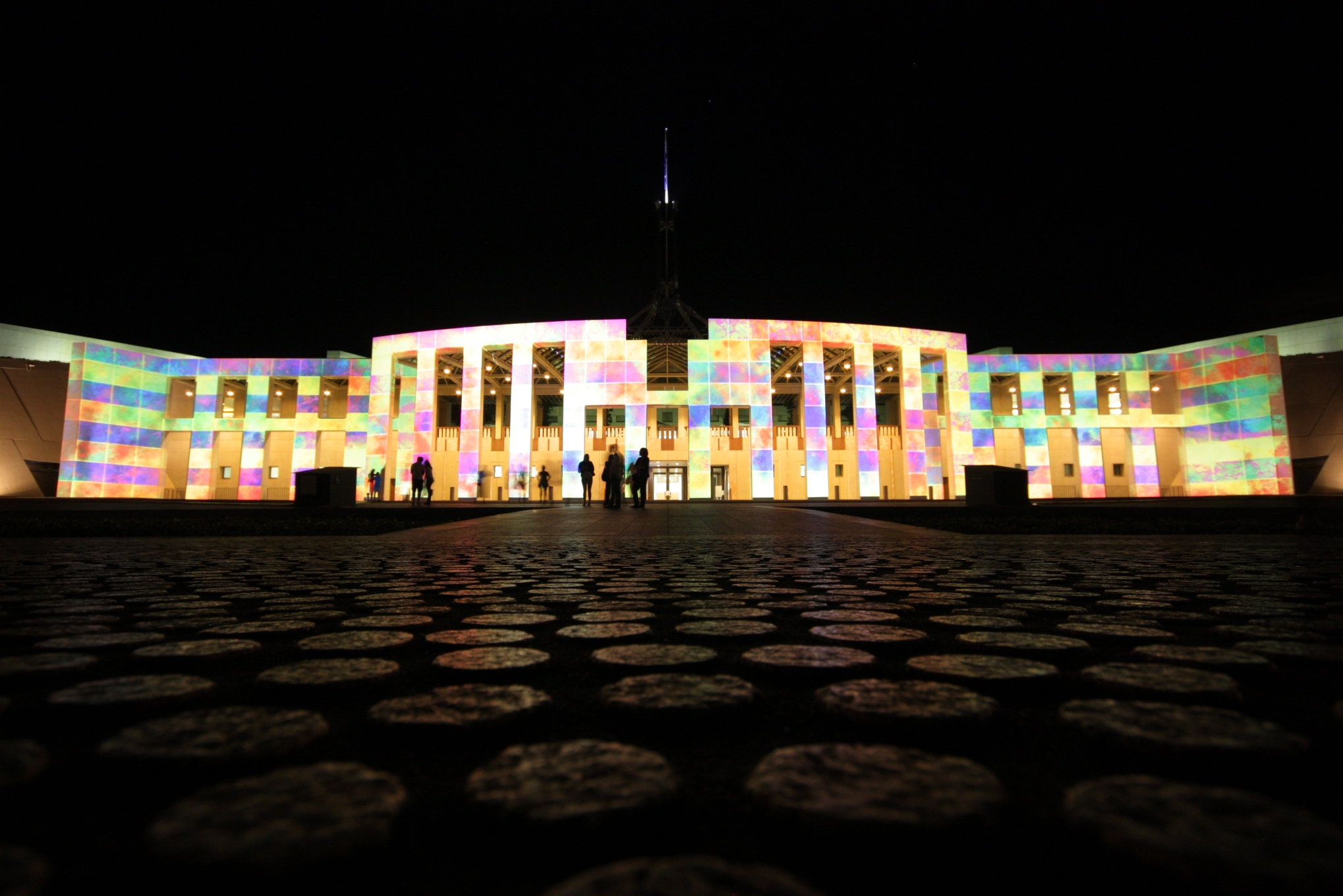
One recent Friday in March offered a sumptuous day of deep blue skies where it was nudging a far from arctic 30 degrees; warmth that seeped into the night and made a very slow amble around the Parliamentary Triangle all the more comfortable. At scattered intervals the huge geometric edifices of the national institutions thrust up as multicoloured beacons, drawing moth-like the throngs of humans revelling in an evening of enlightenment. A beautiful day shifts into a beautiful night.
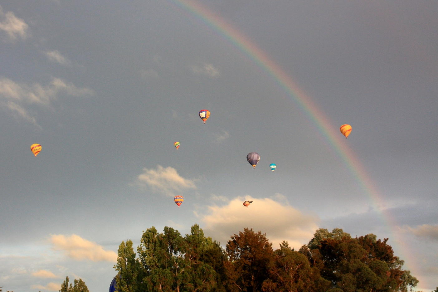
Cooler and with showers threatening, a Sunday morning is cloaked in a pre-dawn gloom. It’s fairly early and the streets are even quieter than usual. It’s that peaceful time of day, a serenity that becomes confronted by parking battles and swarms of people as dawn breaks once more in the Parliamentary Triangle. As quick as the light emerges, balloons rise up from the ground; once flattened tarps smeared across the lawns inflate into rounded bulbs of colour and misshapen eccentricity. The sun sneaks up from the eastern horizon as people wave gleefully from wicker baskets shooting up into the sky. They shouldn’t look so bloody cheerful…they seem to be heading somewhere over the rainbow and into that storm. Oh well, good luck to them, I’m off to grab a coffee.
Monday, and it’s a public holiday, all to celebrate the 101st birthday of a city. Ironically many use it (with the attaching weekend) to flee the place. It’s as if the Prime Minister has just let off the stinkiest fart known to humankind from the flagpole of Parliament House, causing people to rush out onto the Kings or Federal or Monaro Highways in some sense of manic delirium. They head back later on the Monday, once the air is clear.
Being a flexible fellow, and paying attention to the weather forecast, I stayed put until Monday. The day was sunny and I decided – with a spontaneity that still involved making a couple of lists – to head up into the hills for a spot of the old driving-walking-camping experience. It was an enjoyable drive and involved some new road, taking in the Snowy Mountains Highway to Kiandra and then heading over a lumpy and curvy Alpine Way down to Khancoban. There was even – and this clearly denotes a successful road trip – a big thing at Adaminaby. Little over a hundred kilometres from Canberra and it is shameful that this was my first Big Trout sighting.
The barren, frost-scarred plains of this eastern side of Kosciuszko National Park gradually transition as you head west, down through a verdant paradise of tall gums and ferns on the wetter, western side. From here, views of the Main Range are a tad more dramatic, captured at the captivating Olsens Lookout. The plunging of streams can be heard rising from the deeply cut valleys, all making their way, eventually, into the Murray River. Before that, at Geehi Flats, waters trundle along the broad Swampy Plains River, offering a genial spot for camping and, quite probably, Big Trout. Until the storm rolls in…
So much for the weather forecast but I guess these are technically mountains and mountains are known to find weather a fickle companion. With rumbles of thunder close, the rain started pretty soon after parking up, before any swag had been resurrected. With no obvious sign of letting up, and with some distance to travel on slippery surfaces to a town that may or may not have a dodgy motel, I decided to complete my intense road test of a Subaru Outback. Just how well do the seats fold down to form a spacious sleeping area? The answer: well, not too bad…ten extra centimetres of legroom would have been handy but I slept…well…no worse than I would have done in the swag.
Still, it was nice to stretch the legs the next morning which predictably dawned all damp and misty, but dry and with the sun only very reluctantly breaking through clouds. A drive up over the range and heading back east demonstrated the transformation of plant life once again. Near the road’s highest point at Dead Horse Gap things were more barren once more. Perhaps a surprising spot to take a walk but I was pleased, following the course of the Thredbo River into the Pilot Wilderness, to find myself in somewhere just slightly akin to a Dartmoor valley or a Welsh llanfygwryff-y-pobbblygwrwrochcwm.
I was heading along the Cascades trail which leads to a hut called – you guessed it – the Cascades Hut. I couldn’t be bothered to go all the way to the hut (18kms return), but made it to Bob’s Ridge and back (shall we say, with a bit of meandering, 10kms). Being a ridge there were some views, west and south into Victoria, though frequently obscured by stunted and bare gum trees.
Anyway, it was nice to partially recreate the feel of a bit of upland Britain. Being in the Australian Alps I was also happy to try and recreate an Alpine mountain sandwich, consisting of bread, cheese and cured meat. Again, it was no fancy ooh la la baguette avec fromage et saucisson, but filled a hole at the very pleasant riverside setting near the end of the walk.
Of course, on a birthday weekend such as this I need to top off this eating with some birthday cake. I dutifully obliged with a bakery treat in Jindabyne on the way back to Canberra. With a coffee. Borderline country coffee. Which made it undoubted road trip cuisine. Which made a return to Canberra, with its guarantee of good coffee, all the more inviting. And for that, I’m very pleased to wish it a happy birthday indeed.
The Nullarbor is said to be so named because of an absence of trees, i.e. null arbor. The thing is, like other misconceptions that may feature on a jovial edition of QI and set off a high pitched wail, it’s really not so true. Sure, there are a few bits that are made up mostly of low scrub and saltbush, and some of it is very, very flat. But there are plenty of trees clustered and scattered across the thousand kilometres or so of its reach. Plus there is my own festive Christmas tree dangling in the front of the car, attempting to bring some light and joy to this escapade in monotony.
One of the little treats of heading east is that you gradually get to move your clock forward until eventually you get a reasonable sunrise and pleasant light evenings. Not so at Fraser Range, undoubtedly the nicest stop along the road but still subject to the same peculiar hours as Perth. Hello 4am sunshine, before vanishing into a strangely cool, cloudy day to plough through the rest of Western Australia.
At Eucla, close to the WA / SA border there is the concession of 45 minutes but you have come so far east that it makes little difference. And then, ten minutes down the road you suddenly jump forward 1 hour 45 minutes and should you wish to straddle the border it is quite possible to indulge in your own creation of Back to the Future.
Jumping into South Australia there is a sense that civilisation is returning, but it is still 500kms or so to Ceduna, which is itself a subjective interpretation of civilisation. I’m glad to push on another hour and make it instead to Streaky Bay, for a cooling motel room, a chance to endure cricket on TV and nice, long, light evenings to take in the jetty and glassy calm bay of this glassy calm town.
It seems the journey is one of milestones – crossing the border, finishing the Nullarbor, reaching the crossroads of Port Augusta and again seeing a kangaroo for the first time in ages. Bushland and hills return and the environment becomes a more familiar, comforting scene of generic southeast Australian. Stopping and appreciating this at Mambray Creek, in Mount Remarkable National Park, is a delight, even if it means being awoken by huge flocks of galahs clattering around the majestic River Red Gums in the morning.
Adelaide is another milestone and just a few hundred kilometres down the road. I reached the city by way of a small diversion into the northern Yorke Peninsula and a triumvirate of towns – Wallaroo, Moonta and Kadina – at the heart of the Copper Coast. Or ‘Little Cornwall’, a moniker derived from the miners who settled here many moons ago. You would think I would have learnt by now not to get my hopes up with such names, to avoid such disappointments as a ‘Devonshire’ Tea and a ‘Pork’ Pie. But I live in hope that certain culinary heritage items are preserved amongst this flat, agricultural landscape which – apart from the presence of a bit of sea – is nothing like Cornwall.
So it is really not that much of a surprise that despite the slightly cutesy high streets crying out for a charming tea room there is no sign of a cream tea in sight. The closest thing to a scone and jam and clotted cream is a shiny bun with a blob of jam and squirty cream in the middle. Salvation may lie in a traditional pasty, but this is about as traditional as sticking a possum on top of a Christmas tree and singing we wish you a merry Easter. For a start, a pasty tends to have much more meat in and a lot less finely diced carrot please.
Anyway, meanwhile, back in Australia, I reached Adelaide and was glad but slightly daunted by being in a big smoke again. Not that Adelaide is that big or smoky. Indeed, it is rather graceful and refined at its heart. There is decent coffee to have and the fabulous central markets to salivate in and the tram to Glenelg to catch and a short drive to be had to the hills, peppered with wineries and koalas and dinner and conversation waiting. Leaving is a bit sad but there is one final little hill stop in Hahndorf, making amends for a missed German style meat fest opportunity last time around, and a brief reminder of hot summer days in Munich.
After such a lunch it would be a decent idea to nap, but I had new milestones to reach and crossing into Victoria was on the agenda. Three more nights of swagging it, following an inland course close to the Murray River and over the highest hills in the country and down to Canberra. Still 1200km to go but feeling close to the end.
The first stop was among the gums and lakes of Hattah-Kulkyne National Park, a little to the south of Mildura. Here mighty trees rise from the waters, attracting a dense concentration of screeching cockatoos who mercifully quieten down after dusk. They perk up again in the morning, but by now mornings start at a much more reasonable hour.
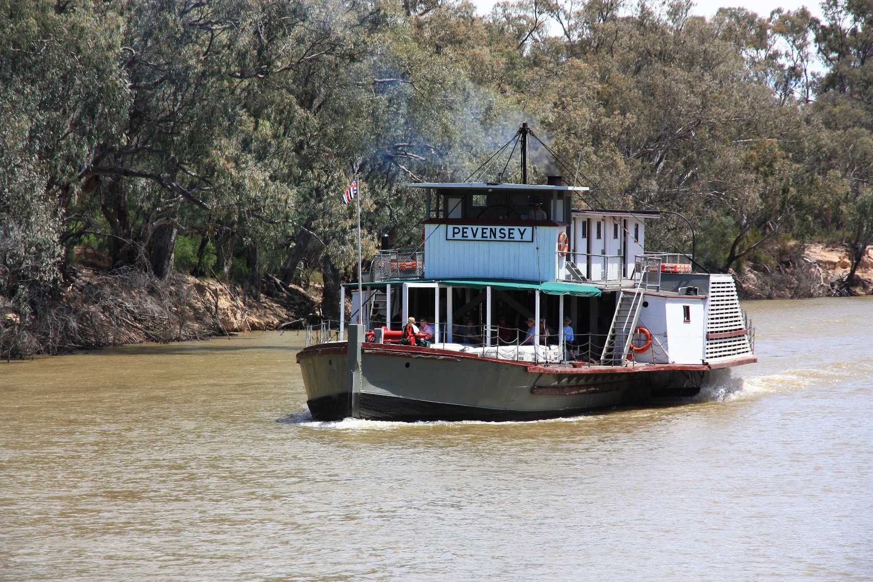
The trees, water and birds combination continues along the length of the Murray, interspersed more frequently with pleasant towns. A reminder that in Victoria country life seems quite amiably civilised. Swan Hill even offered a giant Murray Cod, whilst Echuca evoked steamboat and latticework charm. The thing to do in Echuca is to hop on one of these and cruise upon the river. It made for a pleasant enough hour albeit a little dull.
The Murray rises in the Snowy Mountains and by time I reached Wangaratta I was on very much more familiar ground, stocking up on coffee and cake and heading for the hills. It’s a beautiful approach from Wodonga, following the shores of the Hume Dam with golden hills rising and small valleys drifting into New South Wales. The valleys tighten and become more heavily and lushly forested as they shelter beneath the higher ridges of the Main Range of Kosciusko National Park.
From this western approach it’s quite a twisty ascent over appealing sounding places like Siberia and Dead Horse Gap to a much starker and moodier side. Here a landscape of high moors and glacial hollows is scattered with ghostly snow gums and boggy pools. A world in which leftover snow still stubbornly sticks; a world a long way from Perth where I commenced this journey.
It was rather nice to get out of the car for a late afternoon walk immersed in this landscape, setting off from Charlotte Pass along the Main Range track, dipping down for a Snowy River crossing and up again to overlook Hedley Tarn and Blue Lake. From here it is really not that far as the crow flies to Canberra. Indeed, continuing along the track just a little further, crossing a couple more slushy white patches, you can look out over the ridges and folds of the ranges to the north and east. It is a vast view and I suspect if you had super Legolas vision you might just be able to make out Black Mountain Tower. So, so close.
In a somewhat romantic poetic notion it seems fitting that having traversed and explored huge tracts of this huge country over the past year that I finish it, well, not quite at the top but close enough. It feels like Australia is laid out before me and I can survey what I have crossed…from its white beaches to its desert plains, its golden hills to ragged red gorges, its shimmering cities to one pub towns. And yeah, It may well have the most annoying cricket team ever, and make poor attempts at Westcountry produce, and have strange time variations and a few super long dull roads but, other than that, it seems pretty good to me.
Nothing can be quintessentially more Australian than the sight of a man in a cork hat and grubby white singlet riding a kangaroo to work. Apart from a man on a kangaroo in a cork hat and grubby white singlet hopping over lethal spiders and snakes while fleeing a bushfire with a rescued koala, only to get to the safety of the beach and discovering a shark infested bay peppered with box jellyfish, causing a bunch of boofheads to gingerly enter the water in thongs to retrieve their cricket ball with one hand because the other is grasping onto a stubby of VB like it is the last bottle of insipid but undoubtedly cold beer in the world.
Of course, all of that is nonsense [1], lest I be sued by VB which is a popular and well-loved beer in certain areas and so well-loved it appears on the shirts of the Australian cricket team, which perhaps speaks for itself in so many ways. What is undeniable is that the kangaroo is an icon, so much so that it appears on the national airline and encourages you to buy home grown products. If you ask someone overseas to mention the three things that come to mind when they think of Australia, they will most likely say beaches, kangaroos, and punitive policies for people fleeing persecution and seeking asylum, dressed up as a concern for their safety and not really about winning votes from a cluster of the population who have an underlying xenophobia stemming from their own challenges in paying the mortgage on a home which is unnecessarily big for their needs and encountering traffic on the way to Kmart, thus displacing the blame for this onto others who are widely vilified and helpless to stand up for themselves [2]. Still, we have nice beaches and lots of open space for kangaroos, so it’s worth defending right?
The kangaroo was here long before the first boat people arrived to overrun the country and its culture. A popular myth is that ‘kangaroo’ meant something like ‘I don’t know’ or ‘I don’t understand’ when Cook, Banks et al enquired of local Aboriginals what on earth this peculiar creature was. Like all good myths it has subsequently been debunked [3]but you can understand why it still does the rounds. It’s a convenient story that encapsulates the sense of the bizarre, the other-worldly, the weirdness of the flora and fauna that was encountered by the first boat people. A befuddlement that continues to this day as more people spill, primarily, out of international airport terminals and come face to face with Australia.
Initially you could be forgiven for thinking that Australia is a sunnier, newer, even happier [4] version of the UK, with a US touch of the gargantuan about it. But what sets it apart as wholly unique, exquisitely exotic is its flora and fauna. The kangaroo, perhaps in conjunction with wily white Eucalypt trees and shrieking cockatoos, is the readily available, easily accessible face of the Australian bush, and a long, long way from distant, familiar lands. Perhaps that is why, even after seven years, the sight of a kangaroo bounding out of the trees and across golden grasslands brings a smile to my face and, still, a sense of wonder.
I cannot write about these experiences and this topic without covering time on Red Hill, Canberra. I may have written about this place before. I came across it three days into arrival in Australia, fighting a fight against deep afternoon jetlag driven sleep. Determined not to fall into a coma and then awake all night, I set out along charming suburban streets on one of those beautiful, clear, warming late winter afternoons. It could have almost been an old English summer. Gradually climbing in altitude and property price, the streets ended abruptly as the very richest backed their way onto the grassland and steeply rising bush of Red Hill Reserve. Without intricate knowledge of paths and trails I headed straight up, short and steep to the lookout cafe. Here I viewed Canberra from high for the first time, had a coffee and saw a handful of Eastern Grey Kangaroos milling about without much of a care in the world (much like myself really).
Since that day I almost always saw kangaroos at Red Hill, particularly as I was wont to wander there of an evening. Huge mobs would gather in the grassier patches at the bottom while others would linger along the ridge up high. Mothers and their kids would eye me with suspicion or, perhaps, familiarity. A stand-off ensued, one waiting for the other to move on. But I often emerged the victor in these early days, because I would have my camera with me, and everyone knows that as soon as you bring your camera up to your eye to take a picture of some wildlife, the wildlife flees.
Certainly it was hard to restrain myself from taking a picture every time I saw a kangaroo. It was a natural reaction because back then it was all so extraordinary and therefore entirely warranted. Increasing familiarity has restrained my picture-taking compulsion since. In fact, I don’t tend to take my camera up Red Hill anymore…hell…I don’t even go up Red Hill anymore, since I am presently 3,000 kilometres west and it is a trifle inconvenient. However, frequently armed with camera elsewhere a kangaroo or dozen have popped into view. They emerge within the context of a wider landscape, as natural as, well, a man in a cork hat and grubby white singlet. They undoubtedly add something to the mood, grounding the scene in something that is so very obviously Australian. And thus, still, so very exciting.
————————————————-
Kosciuszko National Park is one of Australia’s great national parks, taking in vast swathes of upland country and river valleys in New South Wales. In winter the highest parts are caked in snow, in summer all parts are swathed in flies. It’s a fairly unique environment for Australia, which is mostly dry, brown and flat. Termed alpine, it is not so in the sense of being blessed with gigantic peaks and glaciers; instead ridges and clumpy mounts offer a scene more akin to the rounded peaks of northern and western Britain [5]. It is an ecosystem that is all-encompassing, from rare possums and miniature toads in the boggy bare stretches high up, to common wombats and kangaroos and all of their derivatives [6] in the bush and plains further down.
Kosciuszko is not so far from Canberra but on one occasion, having spent some time working in the town of Albury, I approached it from the west. It was a long weekend of high country meandering, through the northeast of Victoria and into New South Wales before crossing the Main Range and ploughing on more familiar roads back to Canberra. Approaching the end of March the landscape was in a state of transition, from the dry, warm summer to freezing cold winter nights and winds and rains and occasional snows. The hairpin drive up Mount Buffalo – the closest thing Australia has to an Alpe d’Huez – came with freezing fog that cleared to warm sunshine. The valley town of Bright was commencing its ascent into blushing autumn saturation and wood-fired air. And the trudge along an endless ridge towards Mount Feathertop was blanketed in cloud, a stark contrast to the clear fresh vale below.
Crossing into New South Wales and finally into Kosciuszko National Park, there is eventually a sense that these are proper mountains and not big hills, as the highest points of the Main Range, glowing in the sun above the tree line, rise up more dramatically from this western vantage. The road on this side twists and turns along a narrowing river valley, the dense green bushland plummeting down the hillsides occasionally broken by huge pipes belonging to the mammoth Snowy River Hydro scheme. At some point the road rises and crosses the range at the evocatively named Dead Horse Gap, but before this tortuous ascent, there is respite at Geehi Flats.
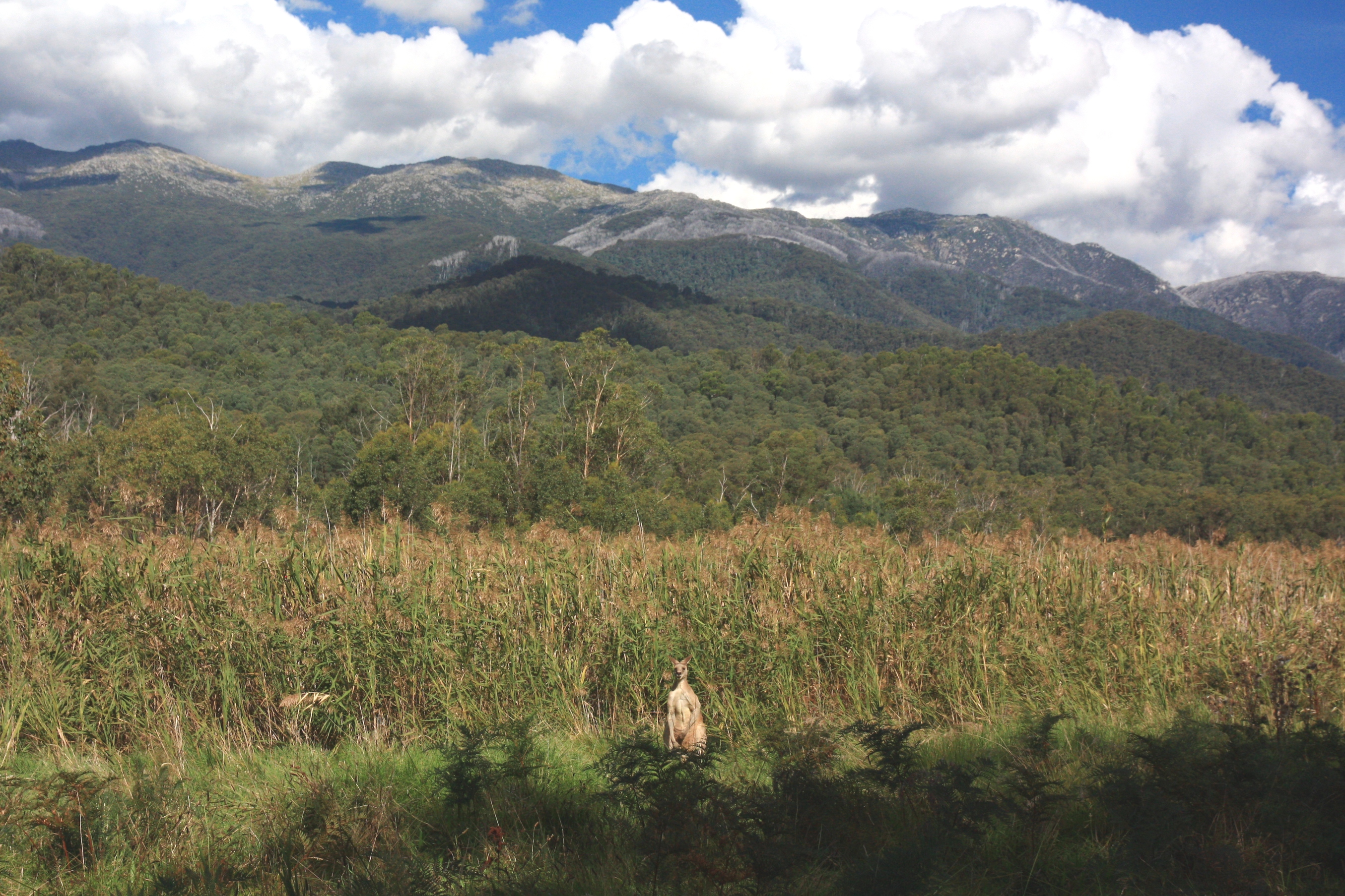
Geehi Flats appears like some hidden valley idyll, where the opaque water of the Swampy Plains River broadens and a swathe of grassland punctures the dark green tangle of gum trees. A spacious area along the river offers rustic camp spots and opportunity to amble. At the northern end a couple of old wooden huts testify to exploration and discovery and, now abandoned, the harsh realities of surviving in the high country [7]. Within this clearing the afternoon sunshine illuminates the rise up to the Main Range and onwards to the white cotton wool clouds hovering above. And as I stare at the serenity, a large Eastern Grey kangaroo stares back. Suddenly I feel like the intruder.
On the face of it, it is nothing remarkable…a sighting of an animal that I have seen hundreds of times before and so common in an area where it is protected to thrive. But in the landscape, in the setting, in the primitive high country context it feels very special, like I am the first white man to see it and it is the first kangaroo to see a white man. It is so amazed that it even lingers while I take a photo. It’s a chunky unit, but it is meagre within the scale of the whole, minor against the vast wildness of the scene. Yet here it sits entirely natural, a perfect foreground marker within the larger composition of my vista. What lies before me is Australia and I am reminded at how fortunate I am to be a part of it. Still a land of untapped discovery, of boundless space and unknown potential, it is something to cherish, to protect, and to share. And while the kangaroo is perhaps the pinnacle of the adaptive powers of evolution, as Australians we can still be much, much better than this.
[1] Clearly we only ride kangaroos around on the weekends for leisure, duh. Else the ute wouldn’t get much use.
[3] Not by the team at Mythbusters I hasten to add, but by (and I quote Wikipedia) linguist John B. Haviland in his research with the Guugu Yimithirr people.
[4] I am unsure about this at the current time of writing, with a UK heatwave and cricket team in the ascendancy.
[5] However, rising above 2000 metres it is far higher than anything in Britain, a boast many Australians like to boast about.
[6] By which I mean the whole raft of hopping marsupial type things like wallabies, wallaroos, euros, jackeroos, jillaroos, brucearoos, kangabies, roosabies, poosaloosaroos etc etc
[7] Like camping overnight, when the warm daytime temperature plummets quite dramatically and uncomfortably


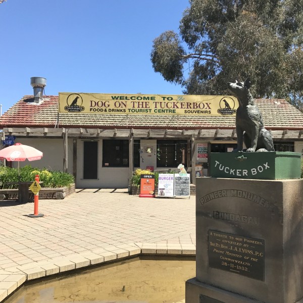 And so the drive out of Canberra almost immediately led to immersion into a flat, golden brown landscape almost devoid of interruptions or scenic highlights. Diverting around Yass and Jugiong and encountering extensive lane closures on the road to Gundagai, distraction naturally came with the Dog on the Tuckerbox. It’s a statue of a dog. On a tuckerbox. But it is sunny and warm and the landscape here more undulating and fertile. Gum trees offer shady refuge for the melodious magpies and chirpy galahs; tin sheds and wooden farmsteads sit snugly among long grasses and fields of sheep; and there are numerous comings and goings to observe at the Tuckerbox KFC.
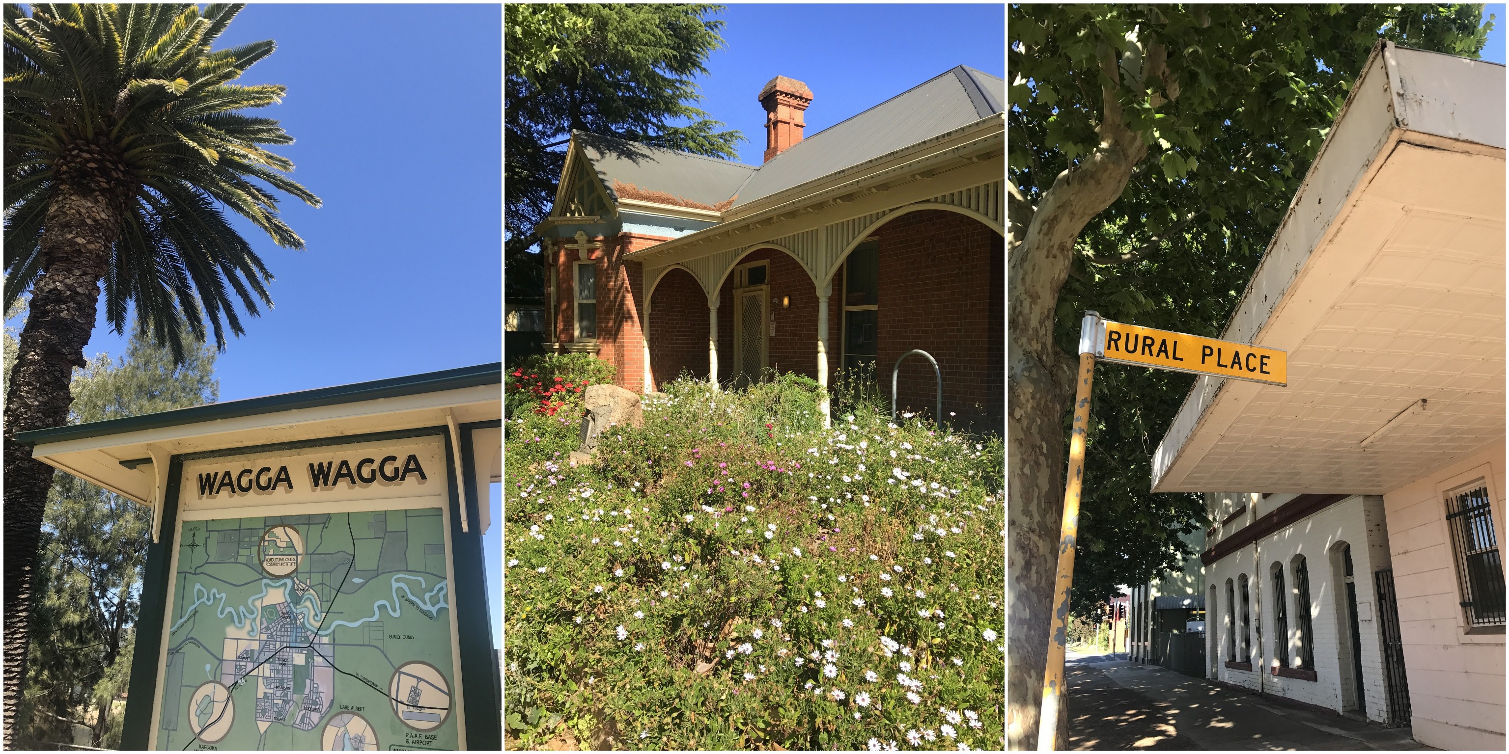
 I enjoyed a late afternoon beside the river, checking out the sandy beach and colourful language of some local ladies engaged in a very open discussion about Tinder and uncles marrying strippers and the like. The beach is obviously no Bondi or Bantham, but there’s sand and water and – I can imagine on those scorching summer days – it has enough going for it to impel you into the Murrumbidgee. Under the shade of eucalypts the vibe is chilled, languid like the river itself and I could have sat here a while if I didn’t have some work to do.
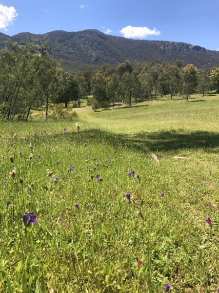 The return trip was far more diverting than a dog on a tuckerbox, mainly because I opted to take a different route back which didn’t involve dual carriageway and bypassing one street towns. The Snowy Mountains Highway stretches all the way down to Cooma, and if I was going to avoid taking a massive detour to Canberra I would have to find my way across the Brindabella Ranges. But first, time for a little bushwalk, just south of Tumut to a slab of rock called Blowering Cliffs. It was a decent jaunt out, starting off through lush meadows and rising ceaselessly through forest to a protrusion of granite. Sometimes a waterfall plunges off here, but today it was like a sporadically dripping tap.
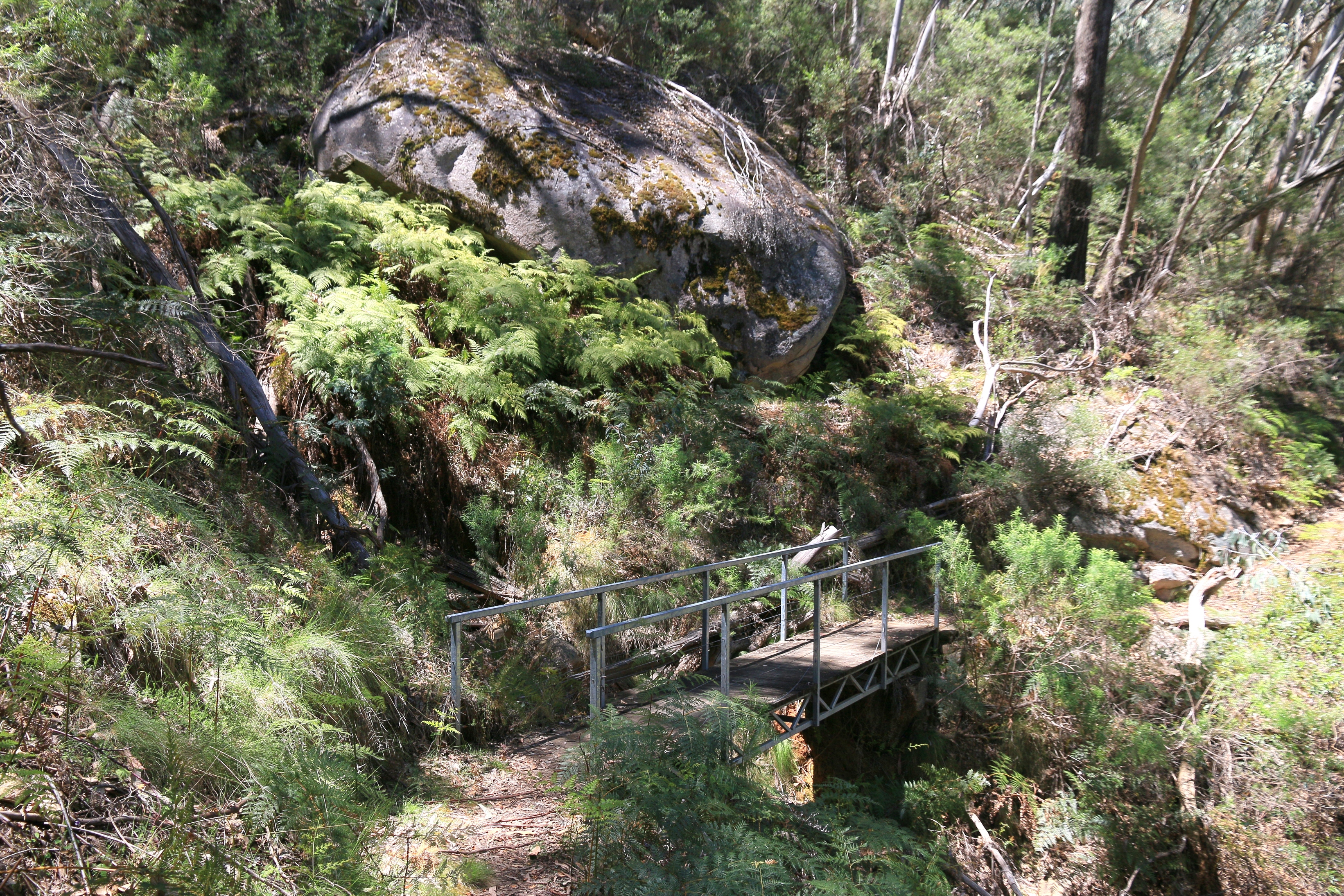

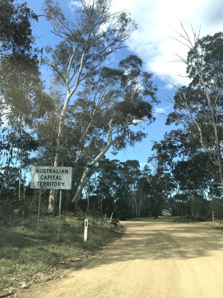 What goes down must go up and so there was some further climbing through Brindabella National Park on more precarious surface before cresting the ranges where the NSW-ACT border sits. I figured out this was my final road border crossing into the Australian Capital Territory and immediately the road surface improved: still dirt but smoother and significantly more tolerant. At the oh-so-ironic Piccadilly Circus I was back on familiar ground, winding down towards the subdued hum of sealed tarmac once more. Back in Canberra comfort, but with the satisfaction of a touch of exploration behind my back.
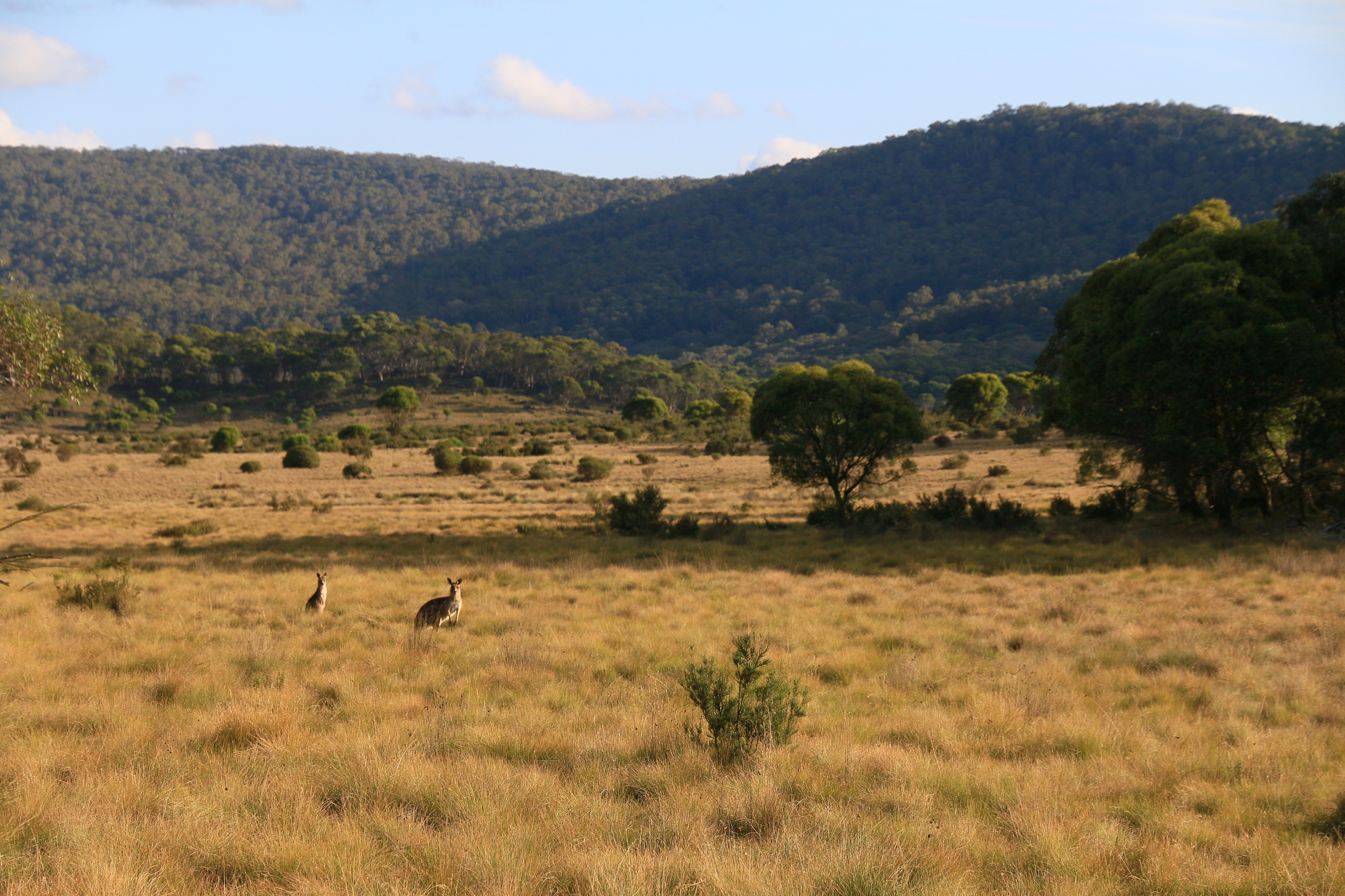
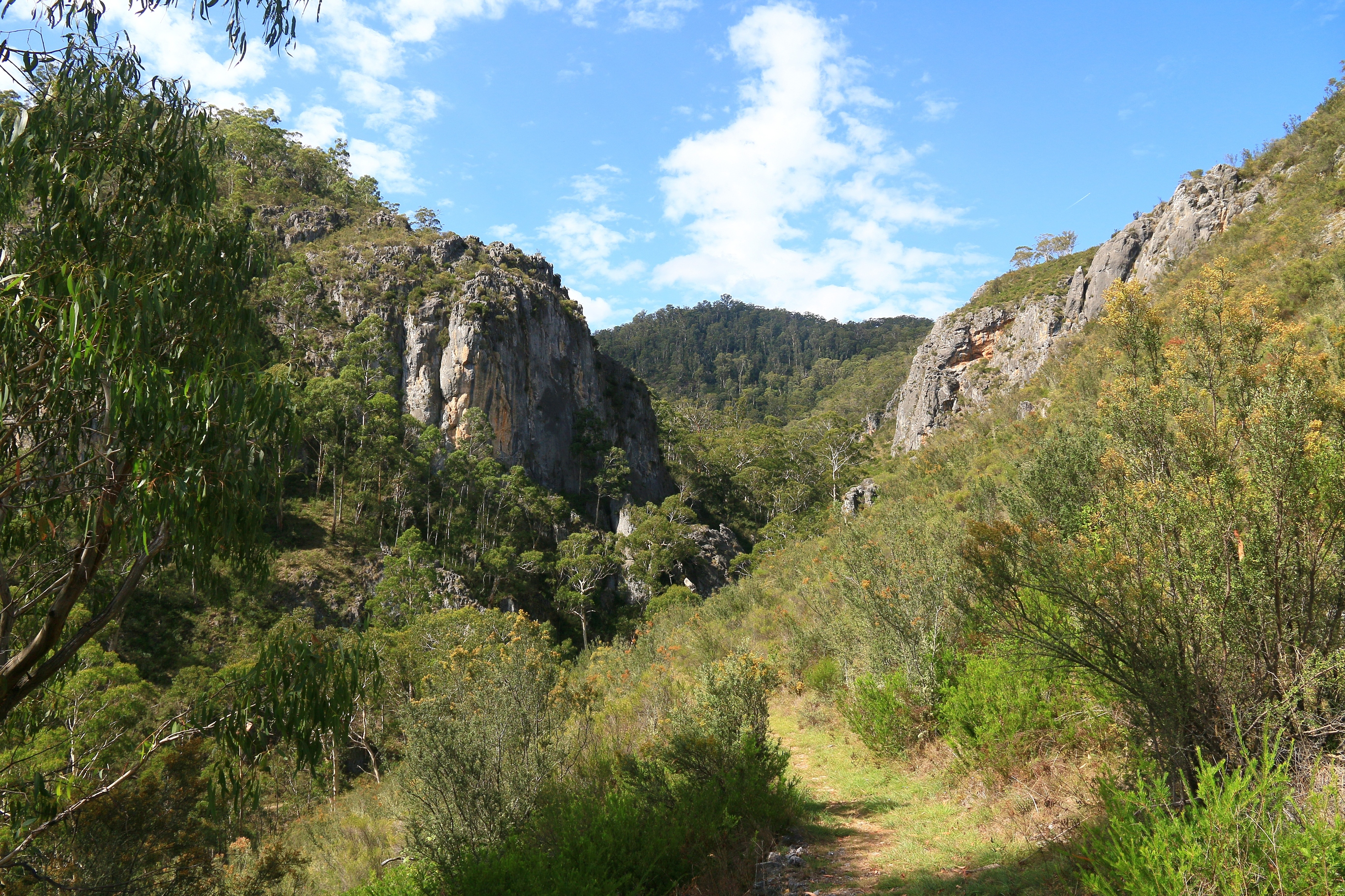
 I have been here before, but that was almost ten years ago. Almost ten years, when I first arrived to live in Australia, intending to stay for a year! I couldn’t remember much of it, though the giant hole in the ceiling of one cave opening triggered something approaching recollection. But the river walk must have been new, at least for my feet, and the thermal pool – a steady 27 degrees all year – offered surprise and consideration for wintertime lolling.
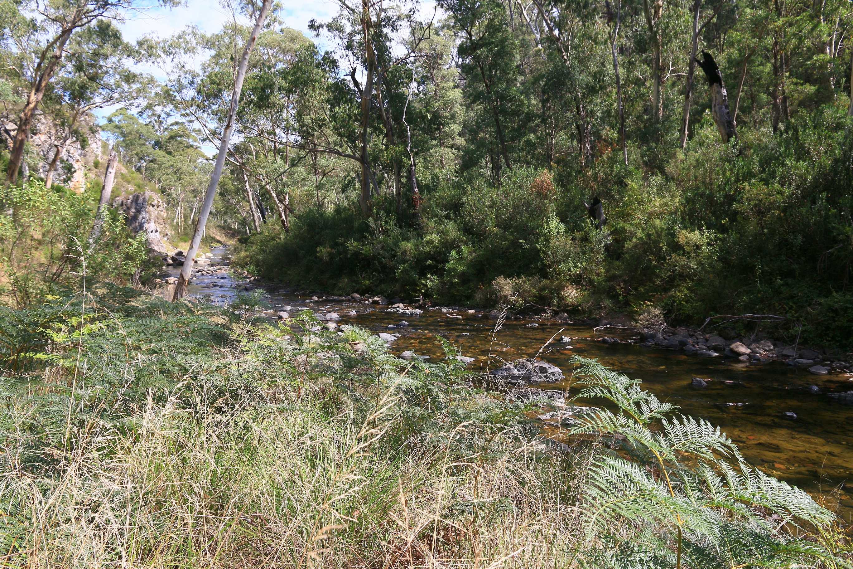


 Age must be affecting me because I am questioning the sanity of camping, even if I have copped out by reverting to the back of the car. Every little thing requires pre-planning and organising, extra time and increased awkwardness. It is effectively homelessness, perhaps more so when you sleep in the car. But then, in the morning, as the misty murk of pre-dawn is dispersed by a welcoming sun, as the deathly still air fills with birdsong, as the wattle and grasses shimmer silver with dew, as you witness the birth of a new day a part of this nature, you know why you do it.
 It is, in theory, possible to clamber your way to the Goodradigbee, but this seems almost as difficult as pronouncing it. Beyond the scenic Blue Waterholes (which enjoyed relative popularity and happy interaction with fellow humans), river crossings and the narrow pass of Clarke Gorge make it too much for someone who is already warm and weary, and has been told to beware of snakes in happy interactions with fellow humans.
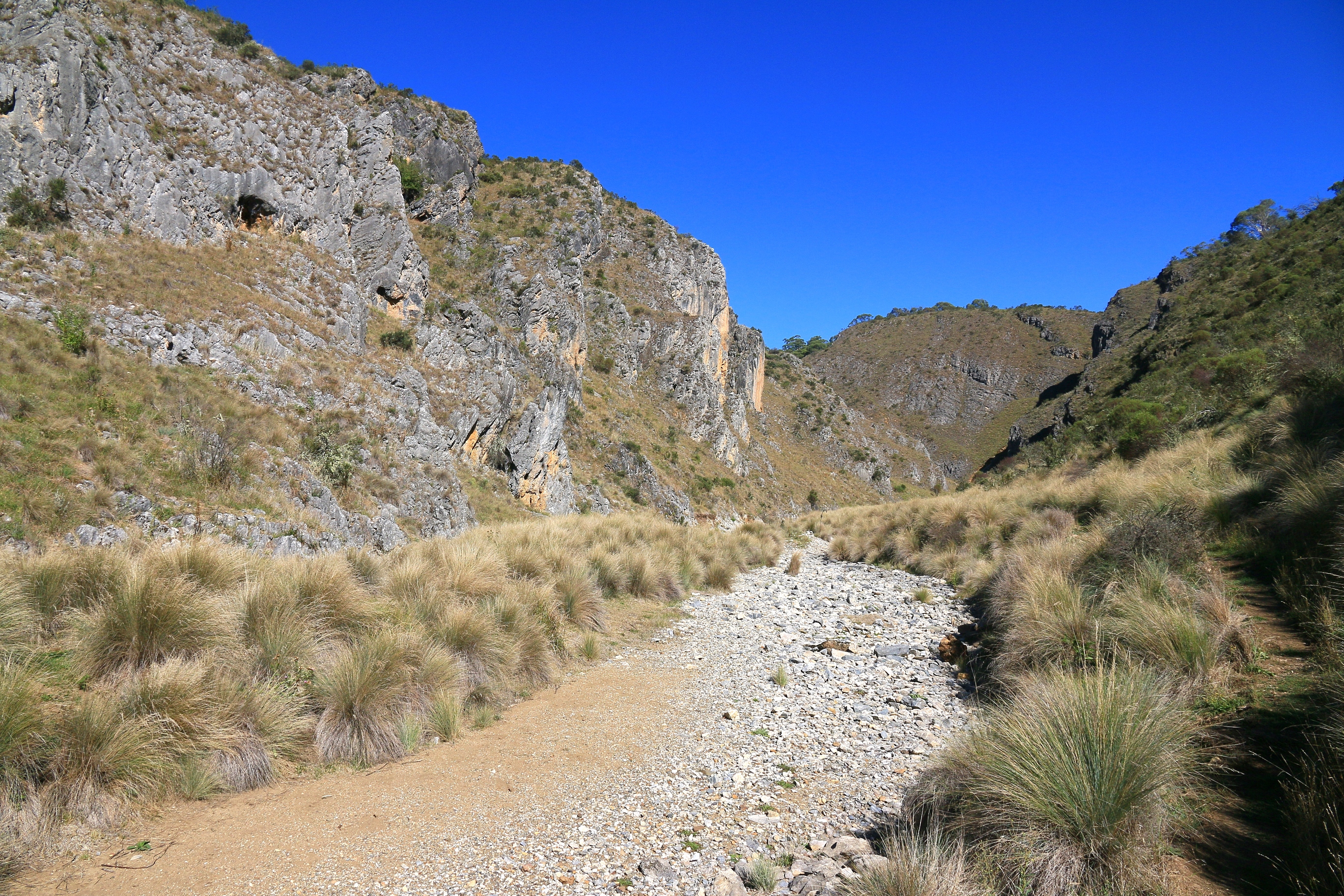
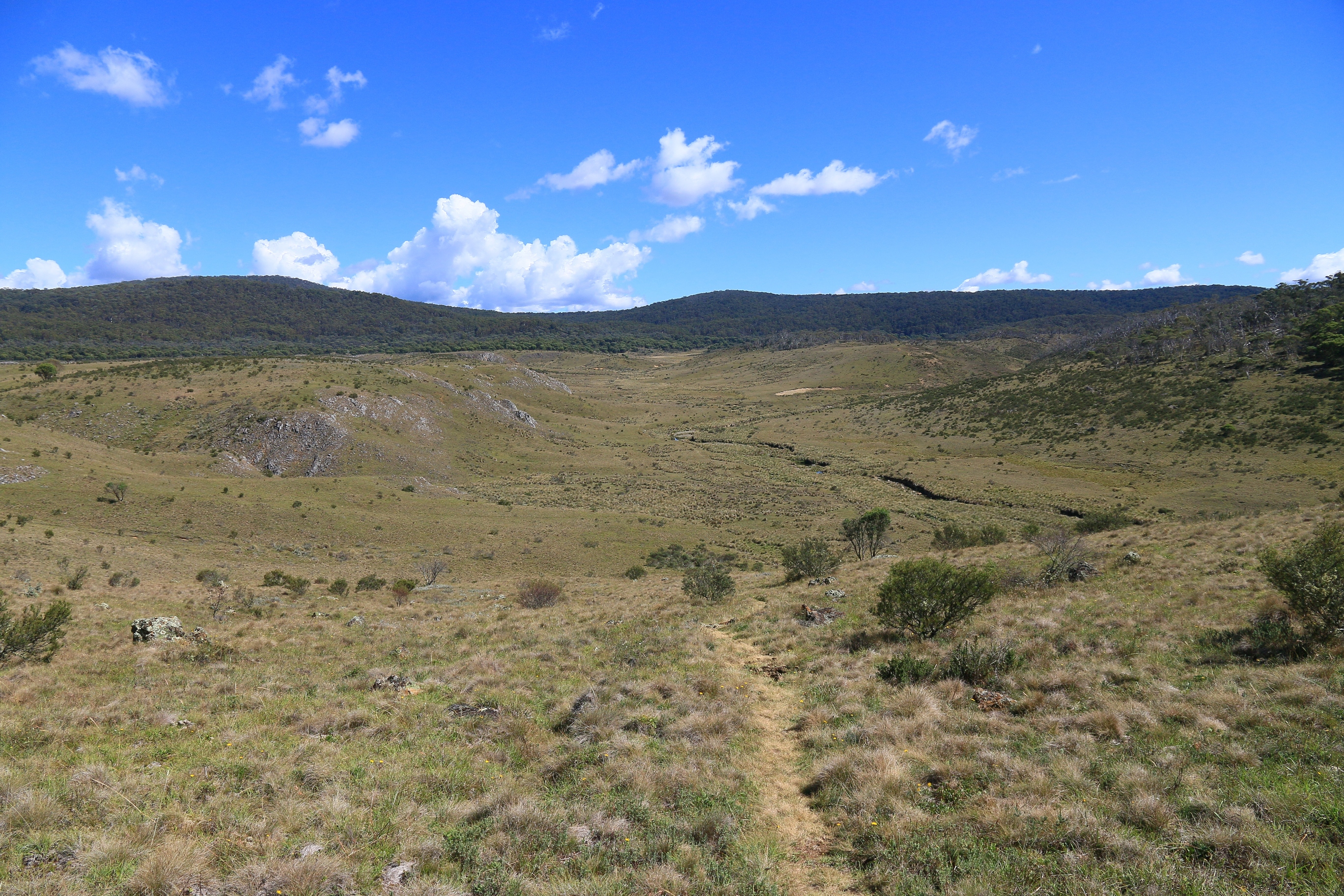

 natural landscape is in much less turmoil (unless you listen to those wacky “scientists” with their corroborated, peer-reviewed “research” and years of undisputed empirical “data”). There are, clearly, mountains to climb and some are easier than others.


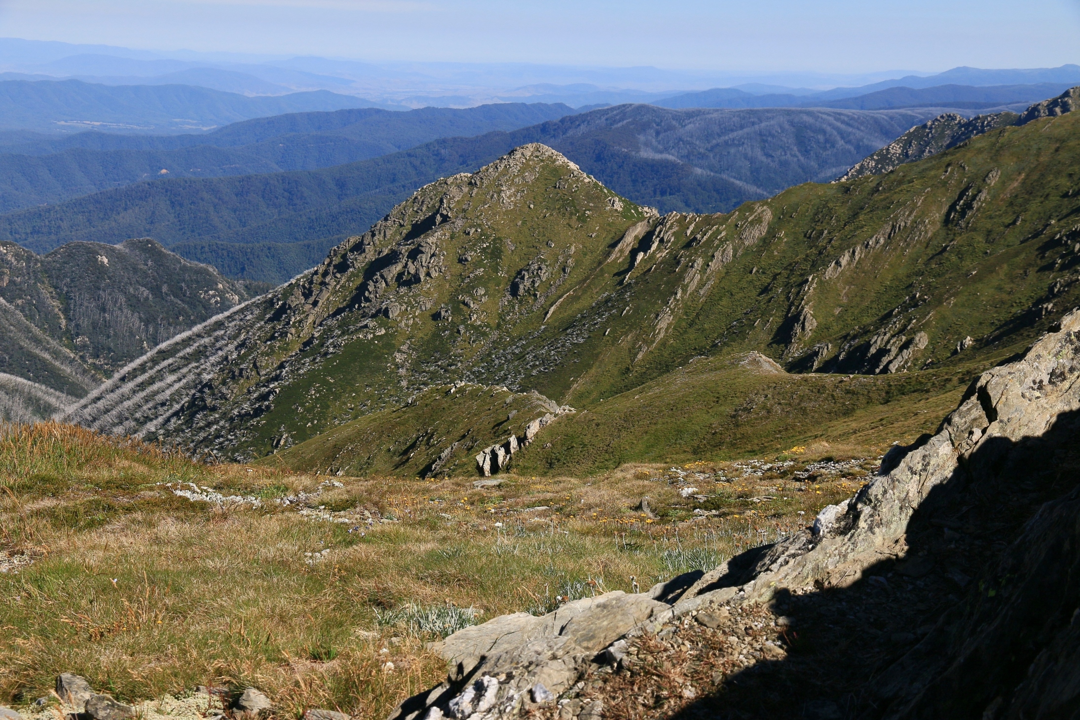
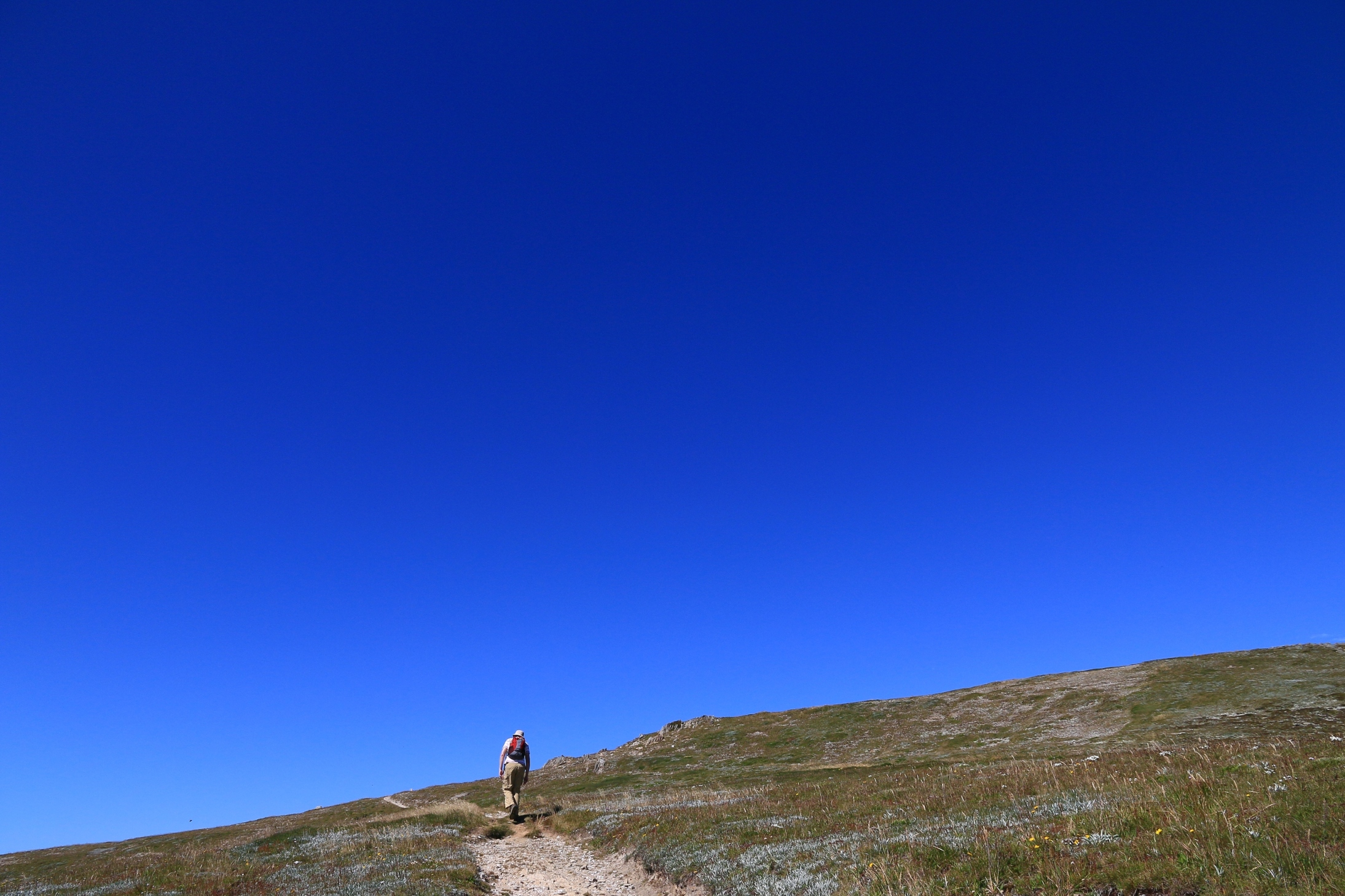

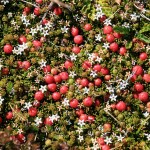 the right and deep ravines carved by Lady Northcote’s Creek, the mountains seeming to tumble sharply west. I have no idea who Lady Northcote was but if her character was anything like that of the landscape in which she was named, she was probably a bit of a looker, though occasionally bleak and somewhat cutting.
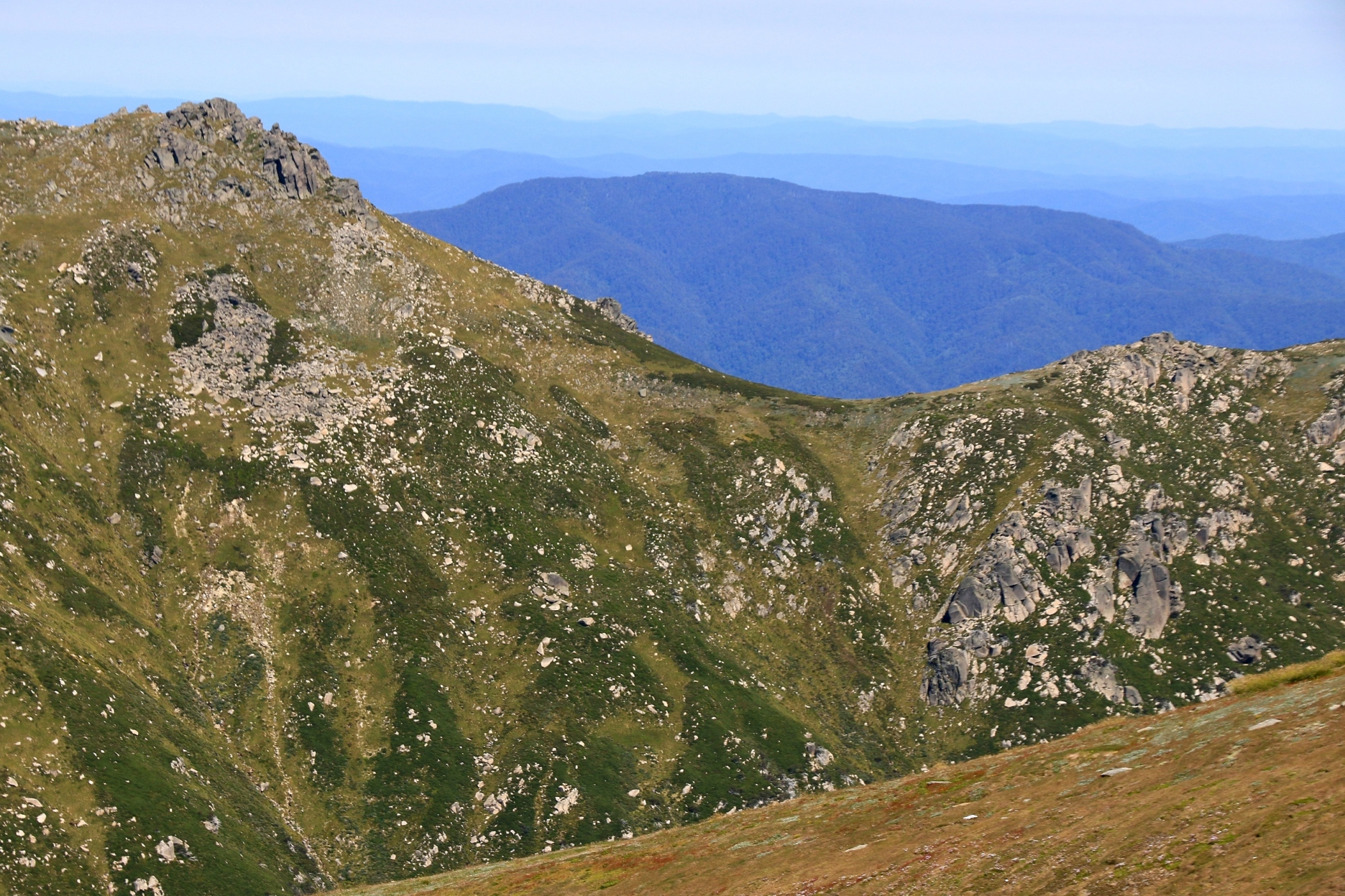
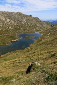 Before too long Albina Lake emerges, tucked in a sheltered valley seemingly conducive to an array of wildflowers and other alpine plants. The lake looks quite inviting in the warmth and would prove a nice spot for a picnic. It’s about nine kilometres into the walk now, and with the summit of Mount Kosciusko just a few thousand metres distant, we resolve to head on and join the masses carrying their lunch to the top of Australia. On reflection, the best part of the walk is over…though this may be in part because familiar paths will soon be rejoined.
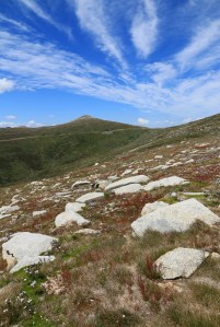 Unfortunately we seem to have gradually descended a little, and the hoick up to the main summit thoroughfare is probably the steepest of the day. We’re not talking rock climbing here, but frequent steps and, by now, quite a penetrating sun. The junction with the main summit trail is like emerging from a country lane onto the M1. Mostly originating from Thredbo, families, fitness freaks and old fogies join us in a steady stream coiling up to the top (2,228m). A medley of Aussie flags and fluoro leggings congregates around the summit marker, and lunching is de rigueur. With homemade hummus and more quiche ours is perhaps one of the more pretentious of picnics!
 summit climb and apparently includes Australia’s highest public toilet – a sedate, well-graded trail makes it all the way back. This is the old summit road and I read that a shuttle bus used to ply along here, part of me wishing it was still running. The open scenery is not unpleasant, but in comparison to other parts of the track and given the gathering weariness this part is a bit of a drag. Markers every kilometre break it up, as does Seaman’s Hut (2,020m) and a more comfortable bridging of the Snowy River with four kilometres remaining.
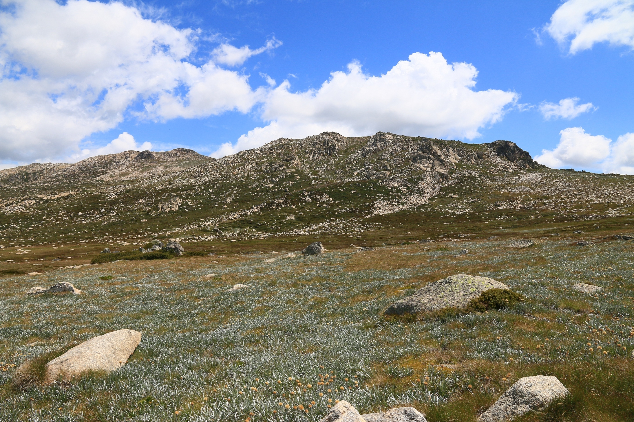
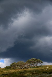 upwards trail to Blue Lake looks like an impressive climb! Snow Gums also cluster here, stunted and bending with their striped, smooth bark of chocolate and sand, of black and white. Afternoon clouds are building and the risk of storms hypothesised look as though they will be realised. But, after six and a half hours and 21.9 kilometres, we reach the (relative) safety of a Subaru Outback. Accomplished and relieved, invigorated and weary; trundling another 220km back to Canberra (577m), via Jindabyne caffeine and Cooma steak. From the real Australia and back to the bizarre.